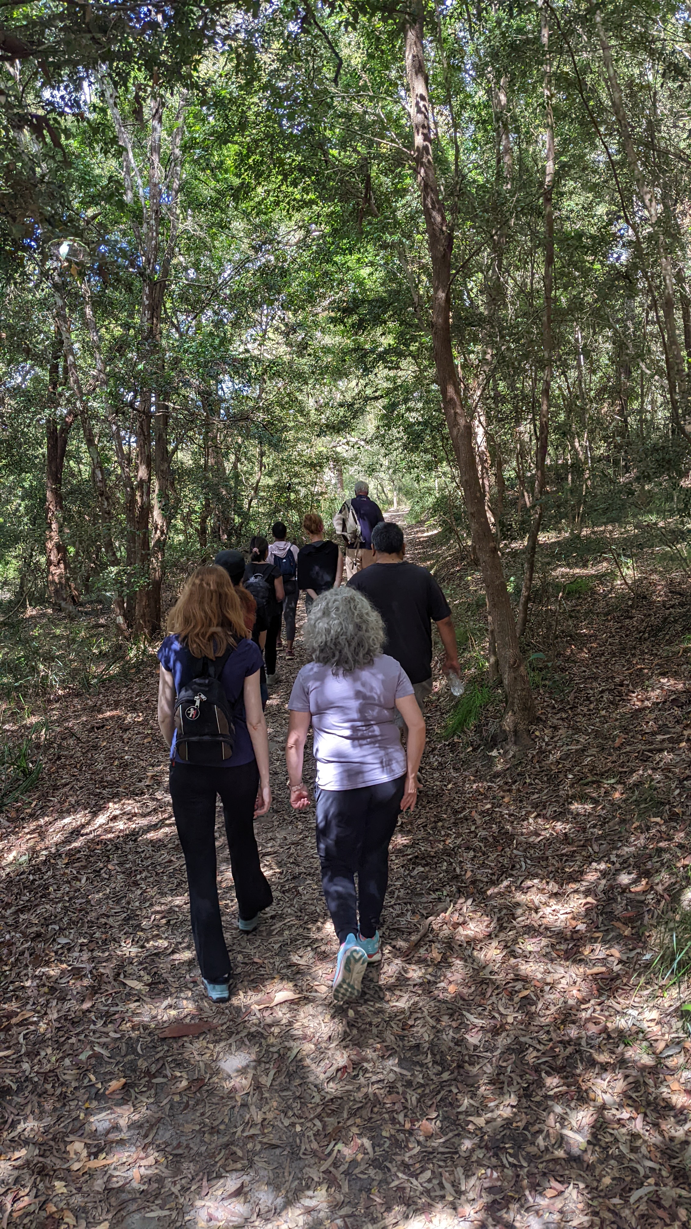
Summary
A moderate walk with some additional hills & steps throughout the Western edge of Lugarno peninsula.
About This Walk
This is a moderate bushwalk with some difficult sections climbing the steps at Banksia Place, and during some parts of the track to Boyd Avenue.
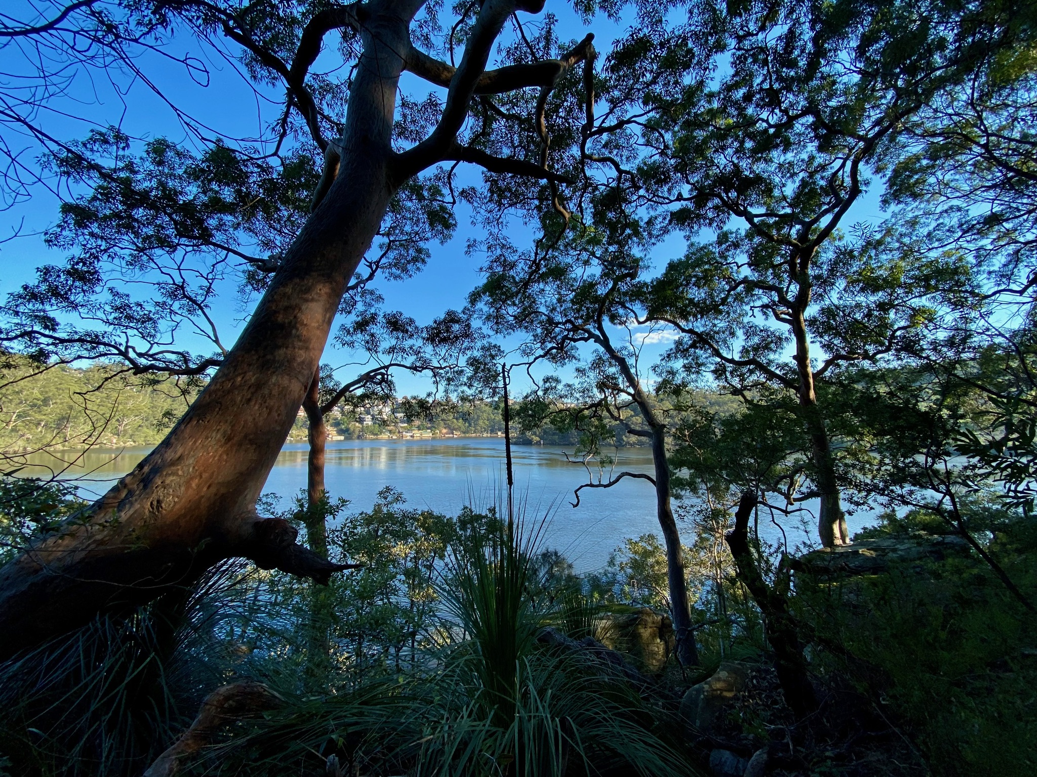
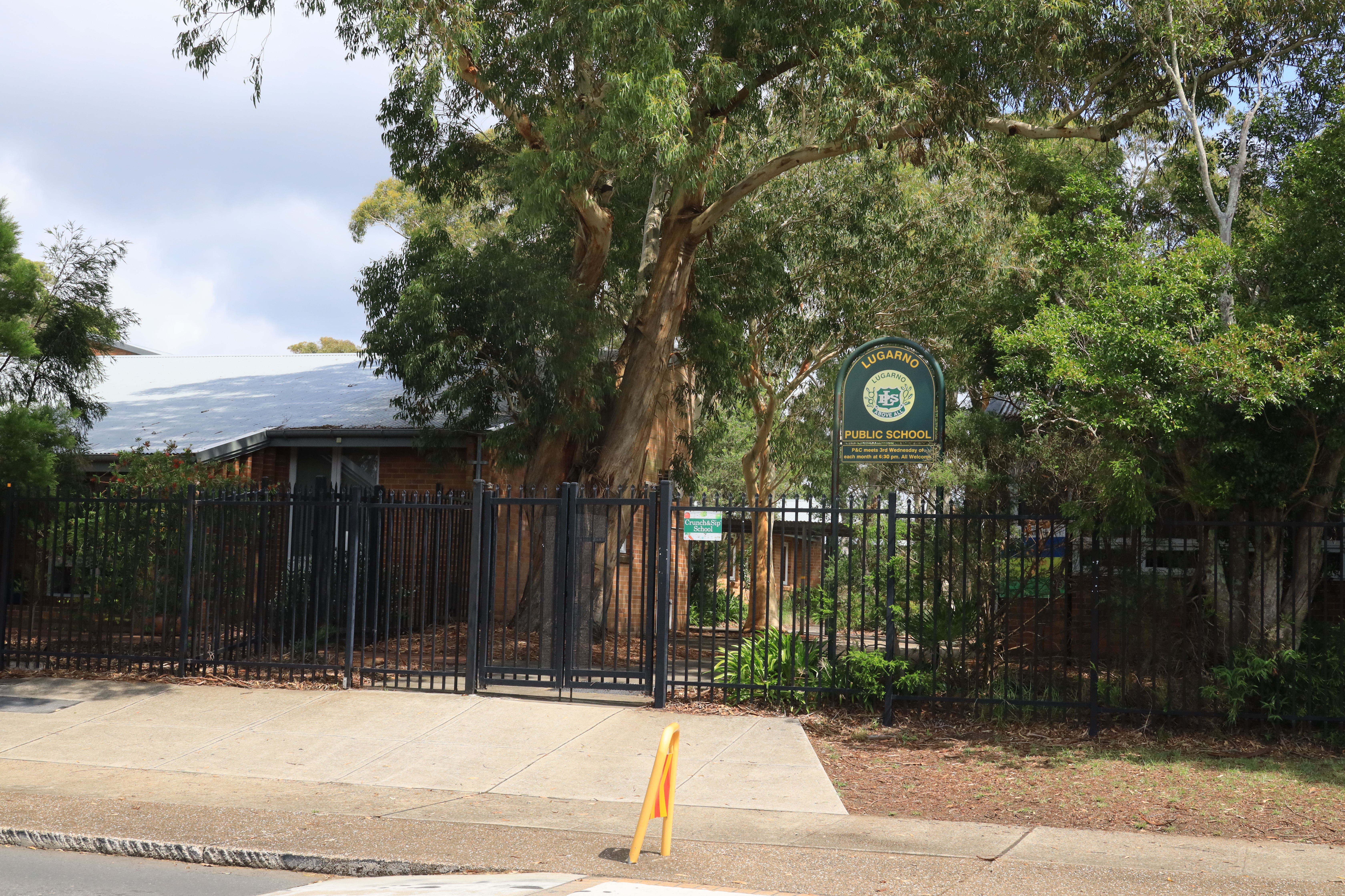
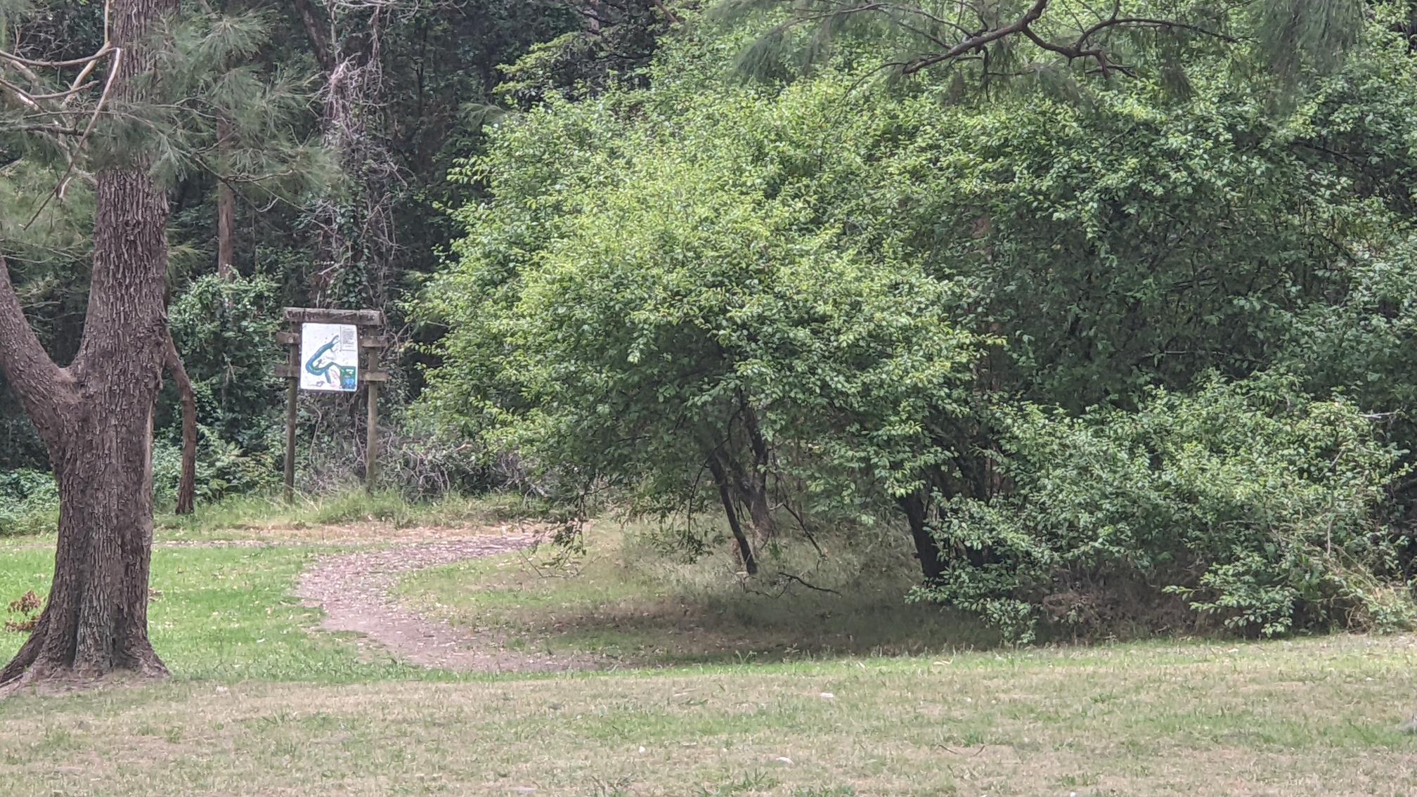
Start this walk near Lugarno Primary School on Old Forest Road, noting its heritage and importance as part of Lugarno's story. Follow the road around into Lugarno Parade, then right into Moons Avenue and down the hill to where it joins Banksia Place. There are wonderful views down to Little Moon Bay on the Georges River. At the end of Banksia Place, climb the steps between the houses up to Allwood Crescent.
Go left along Allwood Crescent and take the track into Evatt Park between numbers 40, 42 and 44. In Evatt park follow the road to your right and note the remains of the old quarry where the cricket nets are today.
Cross the park towards Webbs dam, pass the children's play area and head towards the remaining plum trees from Connor's Orchard.
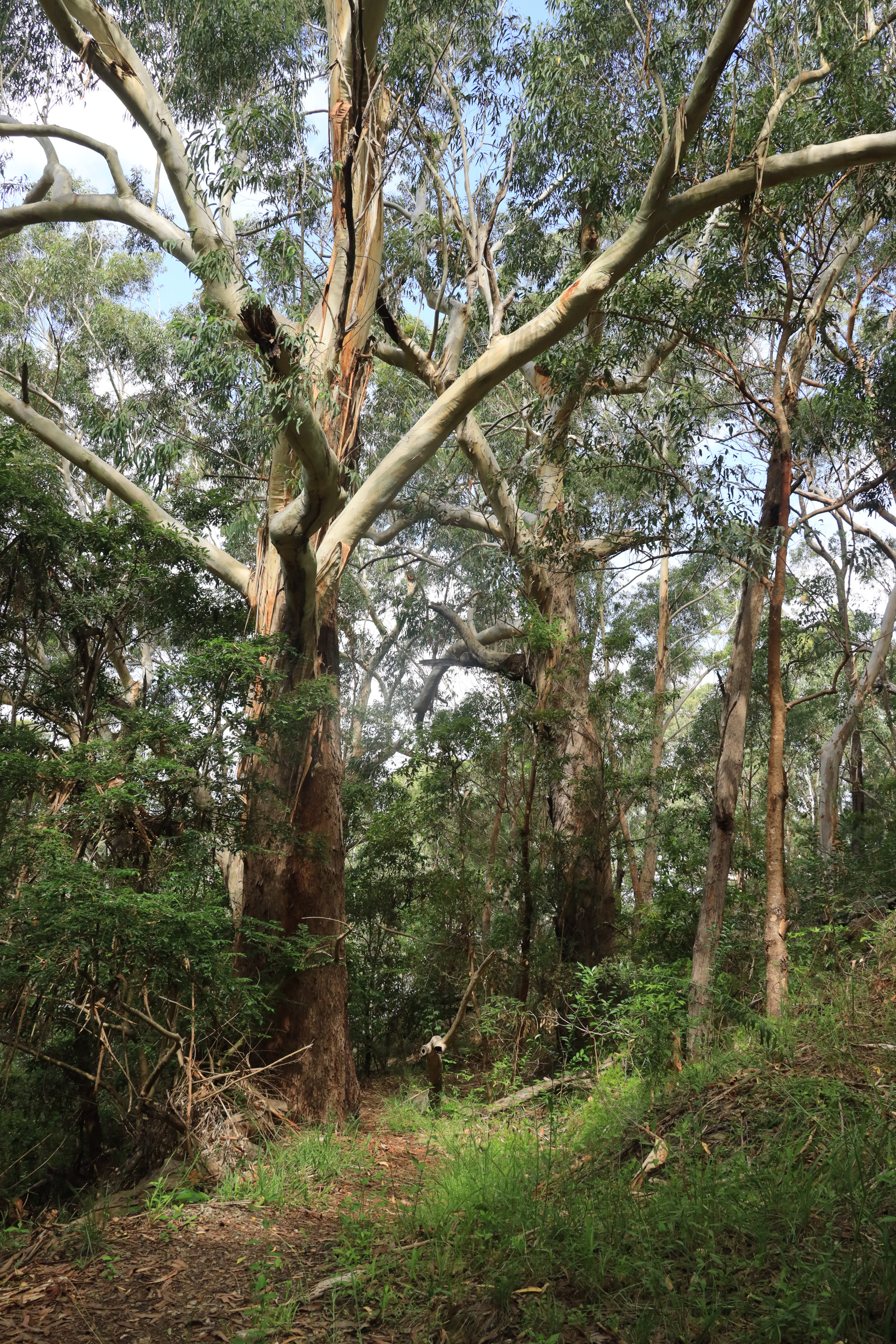
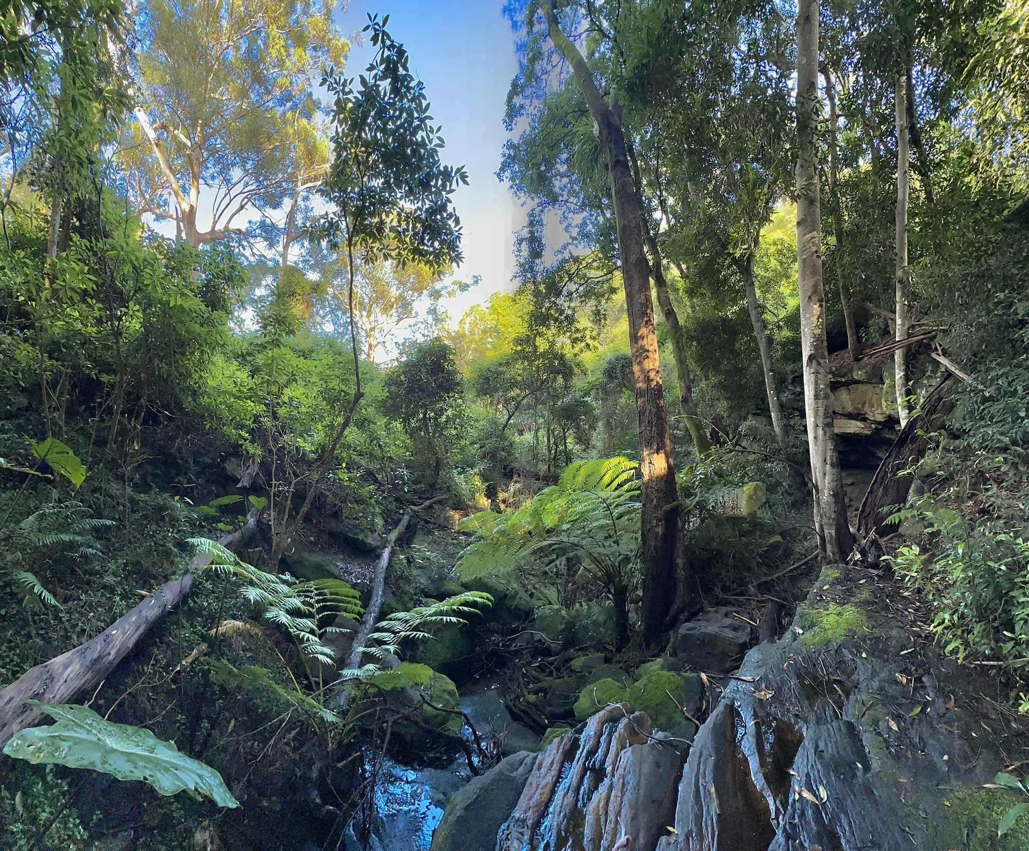
You can then enter the bushtrack around to Blackbutt Avenue, through the rainforest and past the creek, and along the track above the Georges River, taking time to observe the amazing birdlife and views towards the Alfords Point Bridge. This path hugs the Georges River foreshore, staying close to the waterline and then turning inland to the rainforest and H V Evatt park. The traditional owners of the lands here are the Bidjigal people of the Eora nation. Their land includes Salt Pan Creek and the Georges River. They are part of the Dharug language group. They used the river as a travel route, food source and meeting place, with seasonal fishing and shellfish gathering.
At Blackbutt Avenue, follow the road and then left down the hill to Murdock Reserve. This historic part of Lugarno was once the site of the Henley Pleasure Grounds. Retracing your steps up Murdock Crescent, take the track in the bush to your left and follow the bridge into beautiful rainforest. About 10-15 metres further on, there are two tracks. Take the upper track and follow this through to Boyd Avenue. Keep walking along Boyd Avenue and at the bend take the steps and path through to Forest Road. Turning left will take you to Chivers Hill shops.
Walk Layout
Wildlife on this Walk
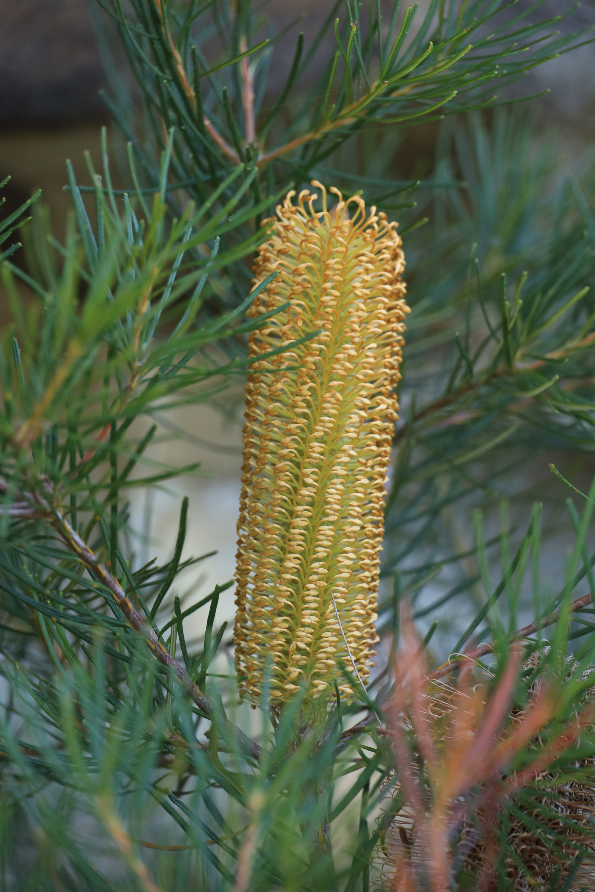
Hairpin Banksia
Banksia spinulosa
Banksia spinulosa
Lacy Tree Fern
Cyathea cooperi
Cyathea cooperi
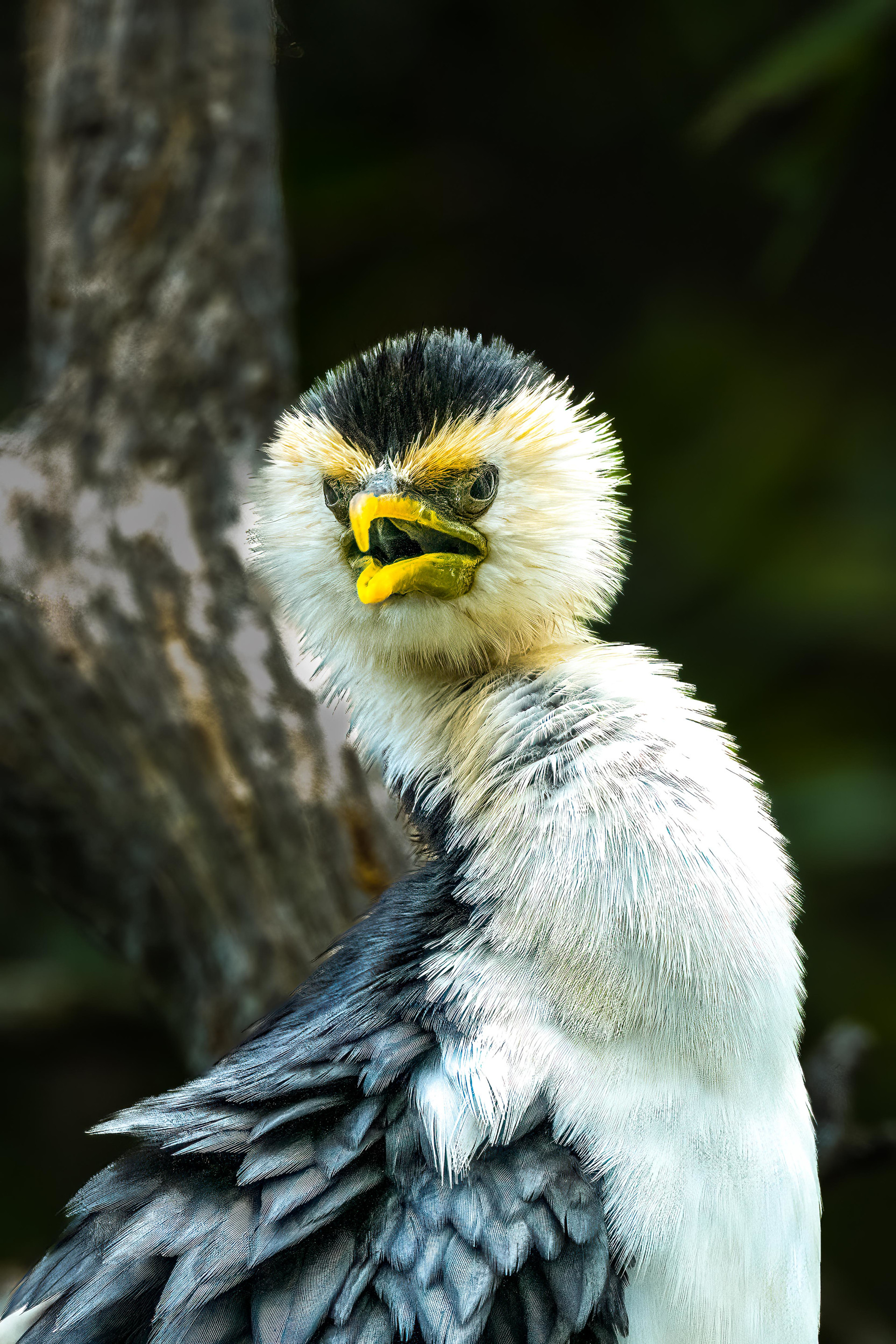
Little Pied Cormorant
Microcarbo melanoleucos
Microcarbo melanoleucos
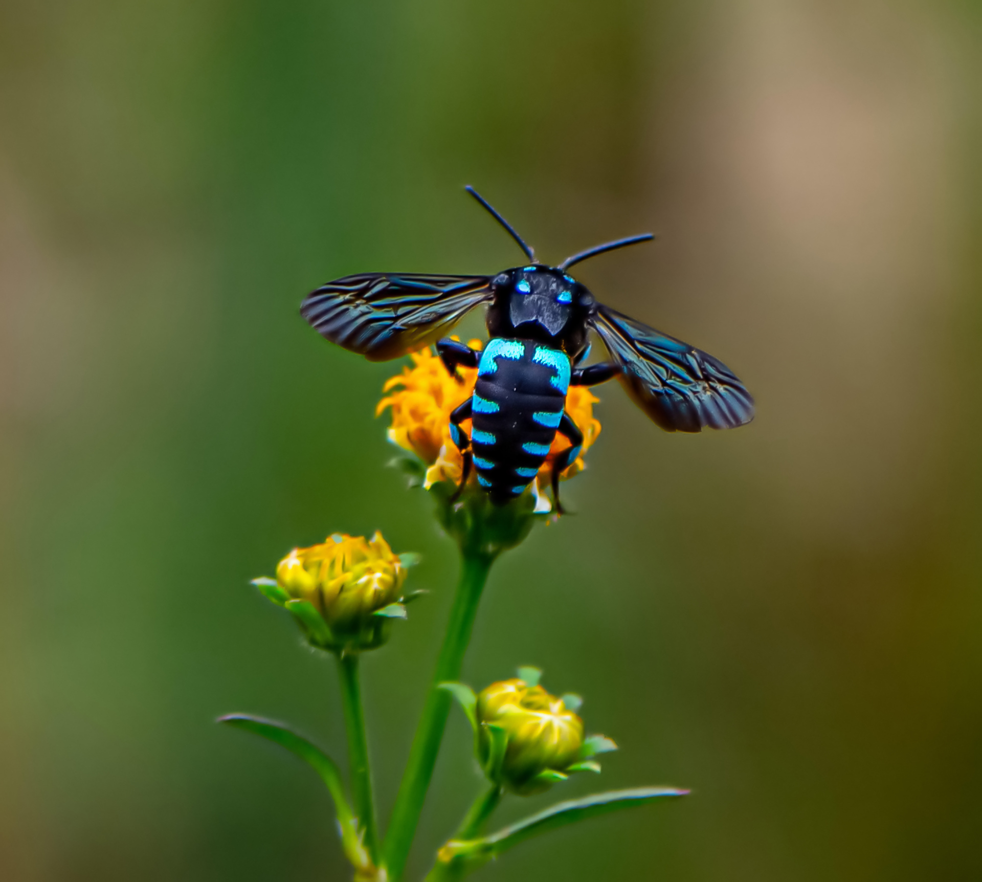
Neon Cuckoo Bee
Thyreus nitidulus
Thyreus nitidulus
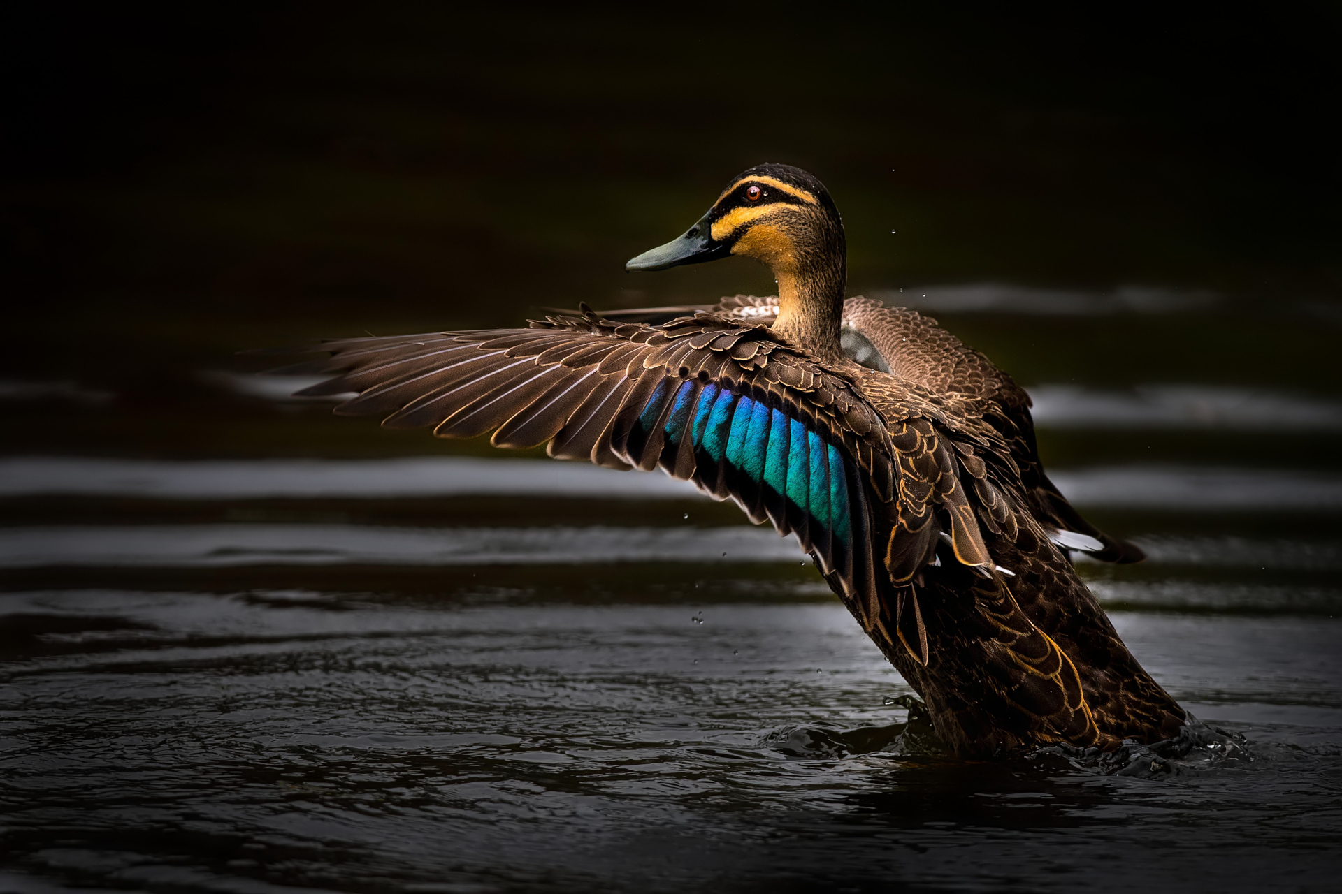
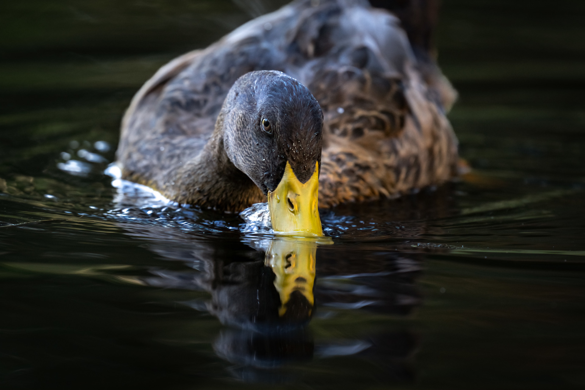
Pacific Black Duck
Anas superciliosa
Anas superciliosa
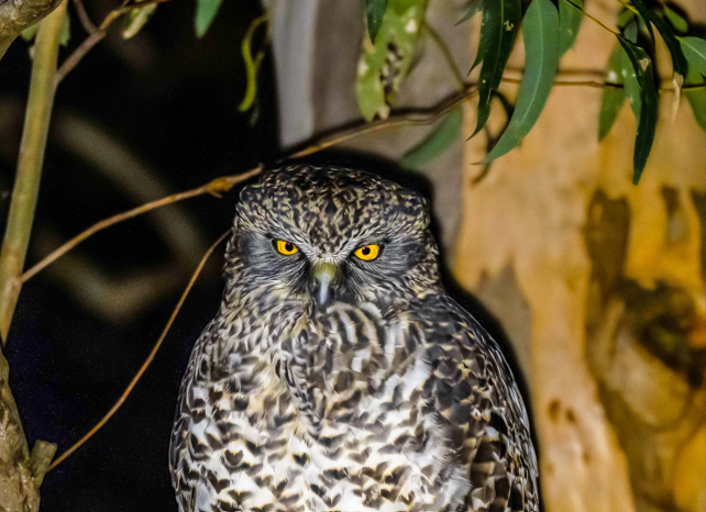
Powerful Owl
Ninox strenua
Ninox strenua
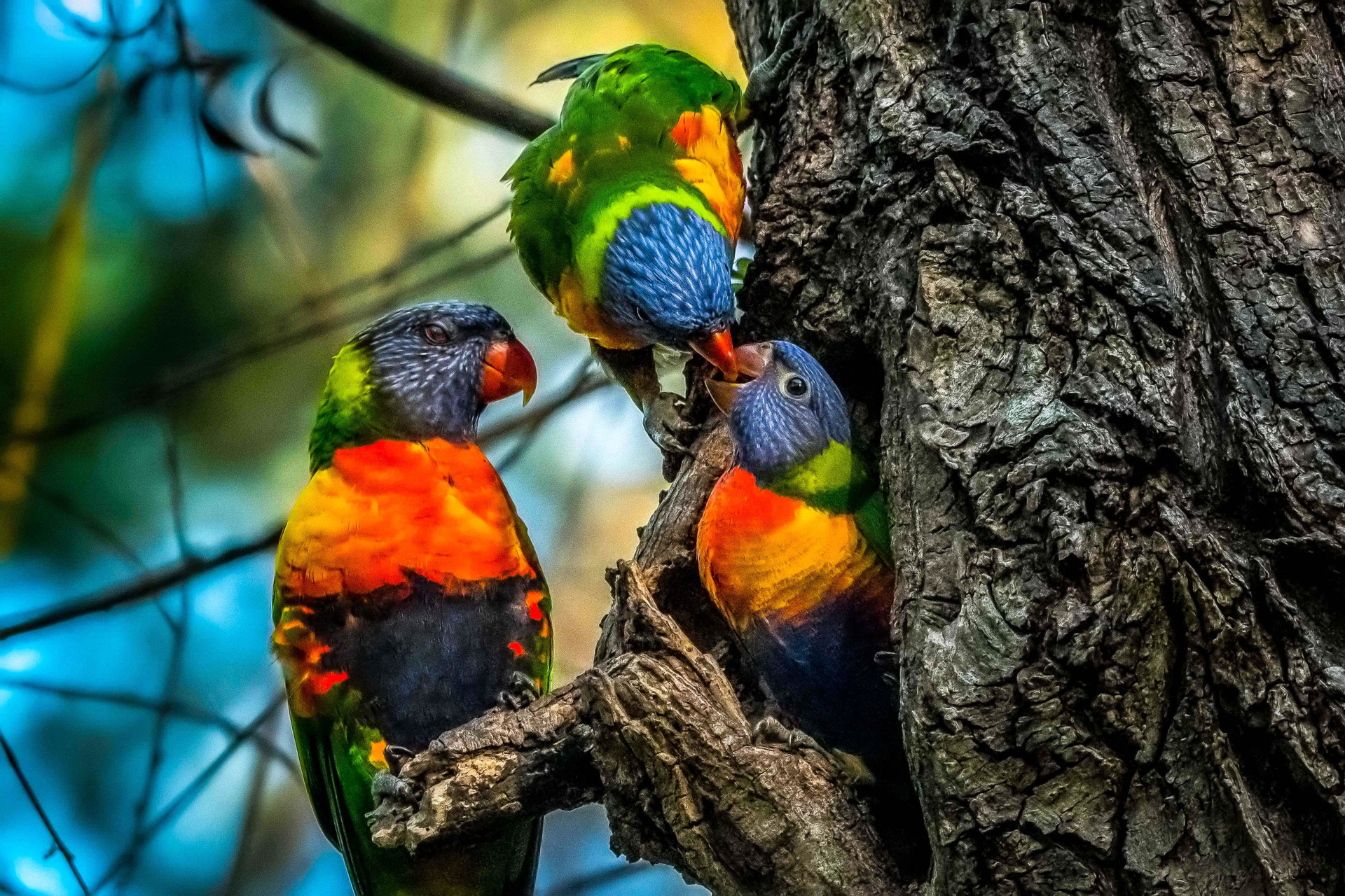
Rainbow Lorikeets
Trichoglossus Moluccanus
Trichoglossus Moluccanus
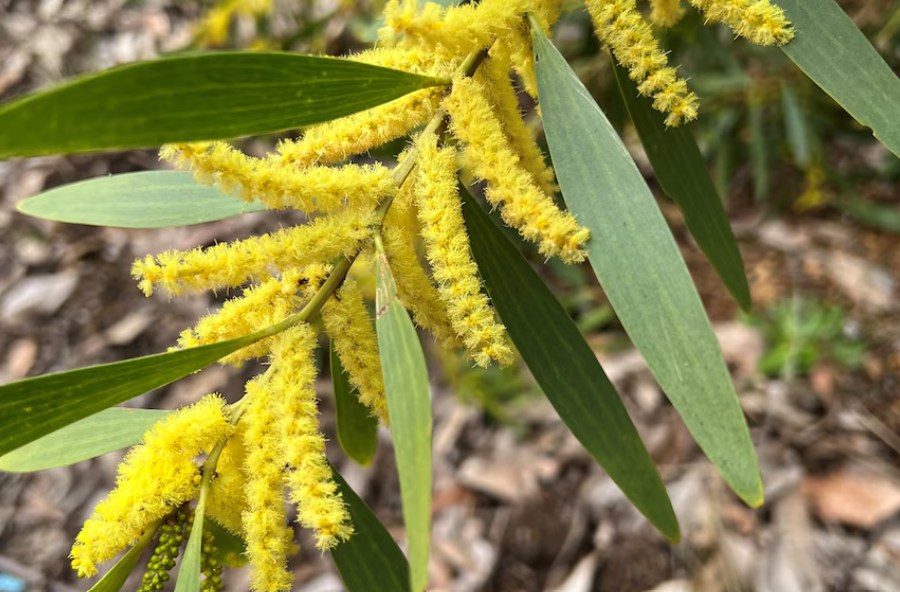
Sydney Golden Wattle
Acacia Longifolia
Acacia Longifolia
Sydney Red Gum
Angophora costata
Angophora costata
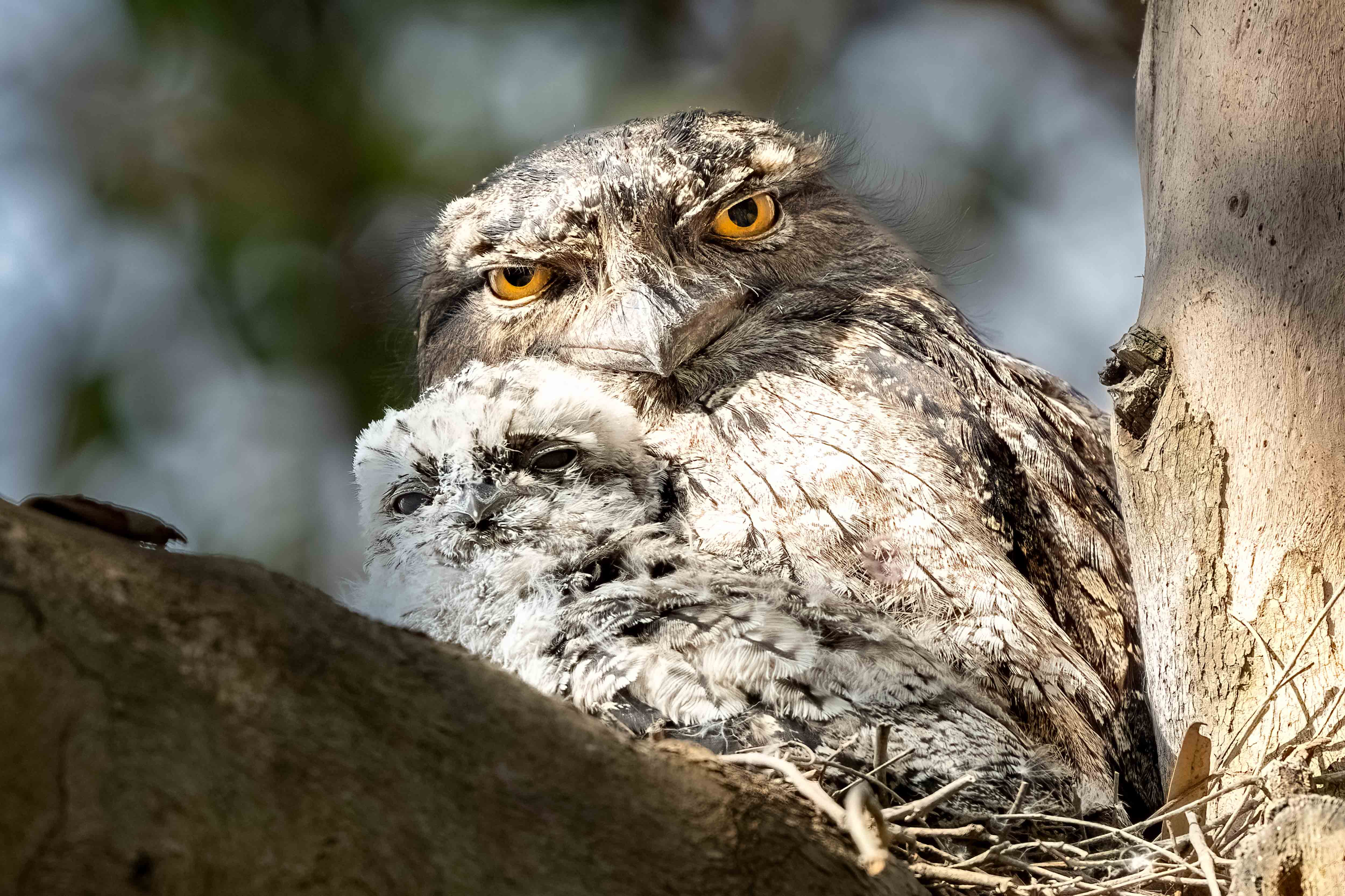
Tawny Frogmouth
Podargus strigoides
Podargus strigoides
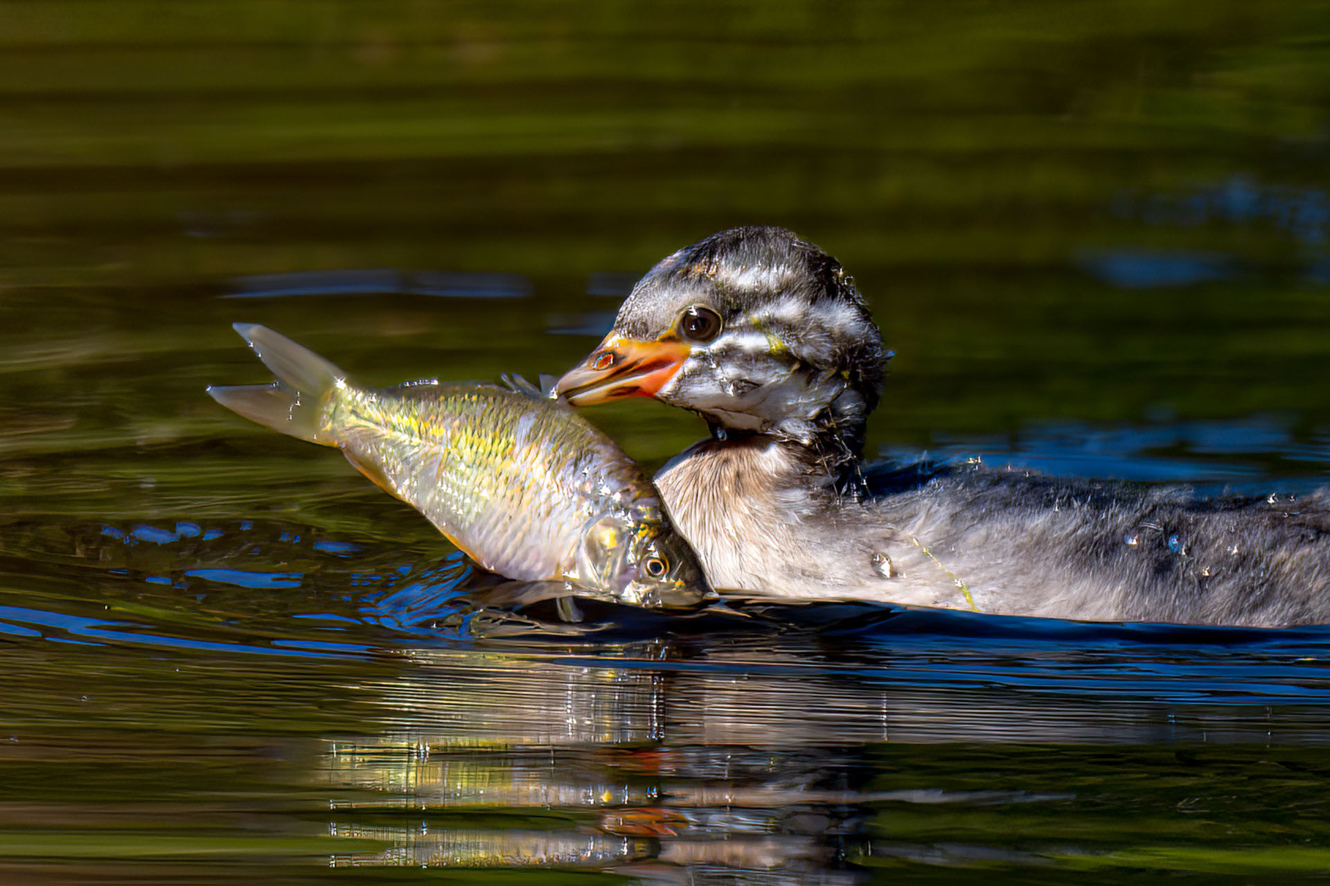
Australasian Grebe
Tachybaptus novaehollandiae
Tachybaptus novaehollandiae
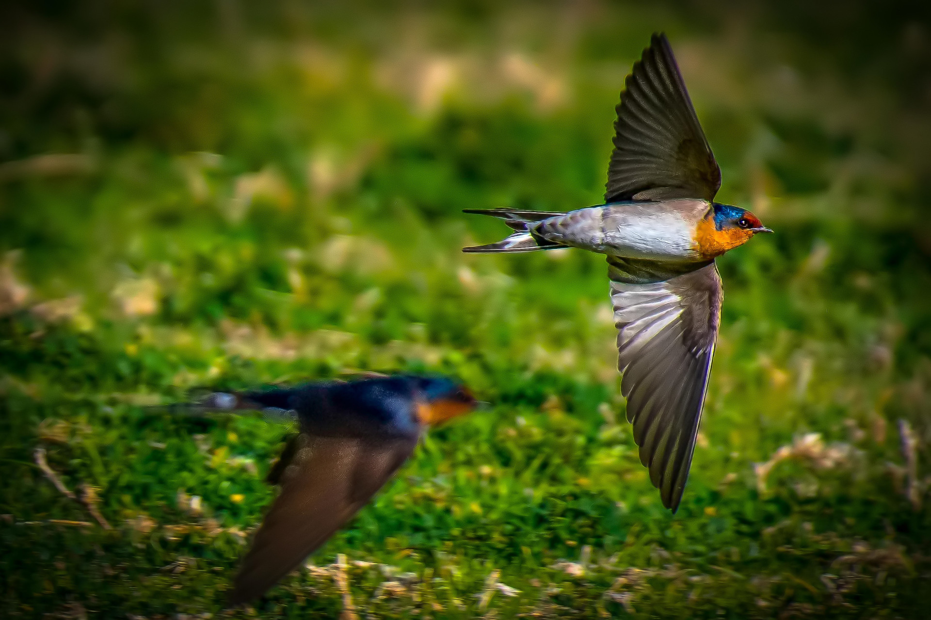
Welcome Swallow
Hirundo neoxena
Hirundo neoxena
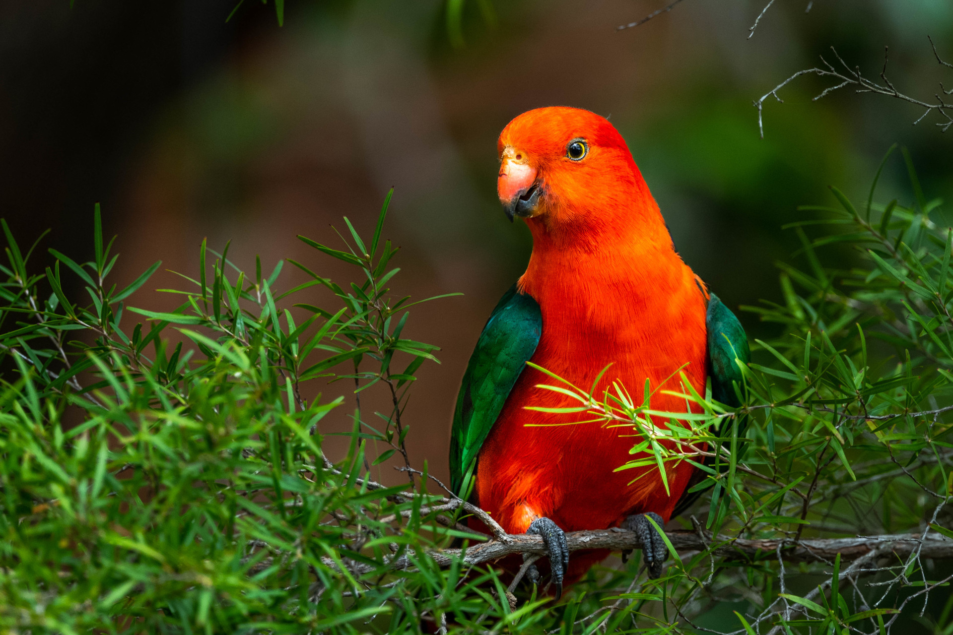
Australian King Parrot
Alisterus scapularis
Alisterus scapularis
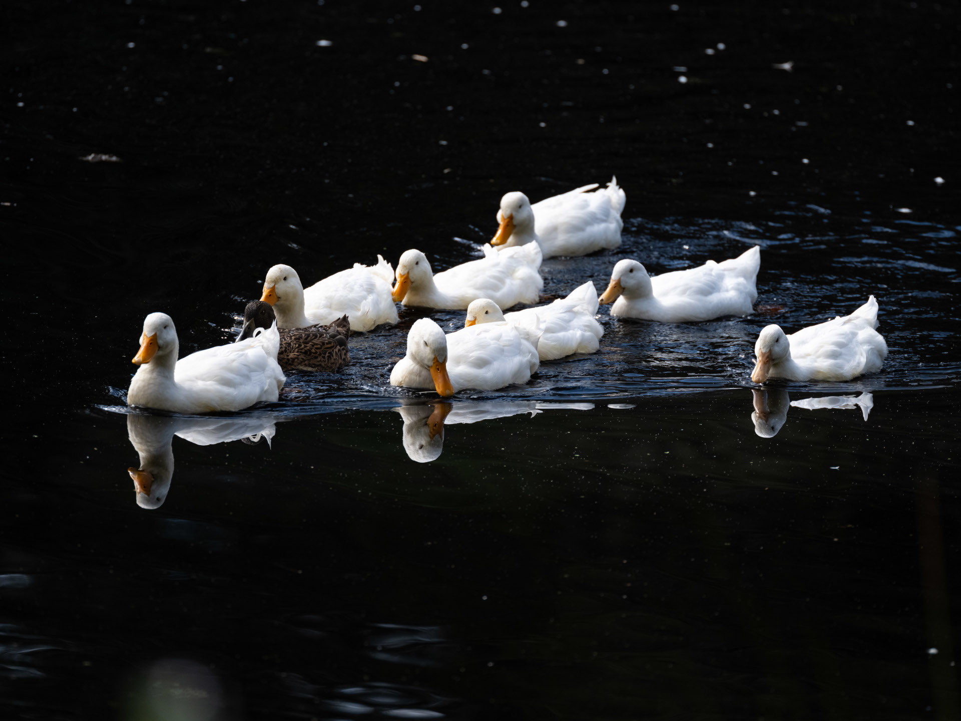
White Pekin Duck
Anas platyrhynchos domesticus
Anas platyrhynchos domesticus
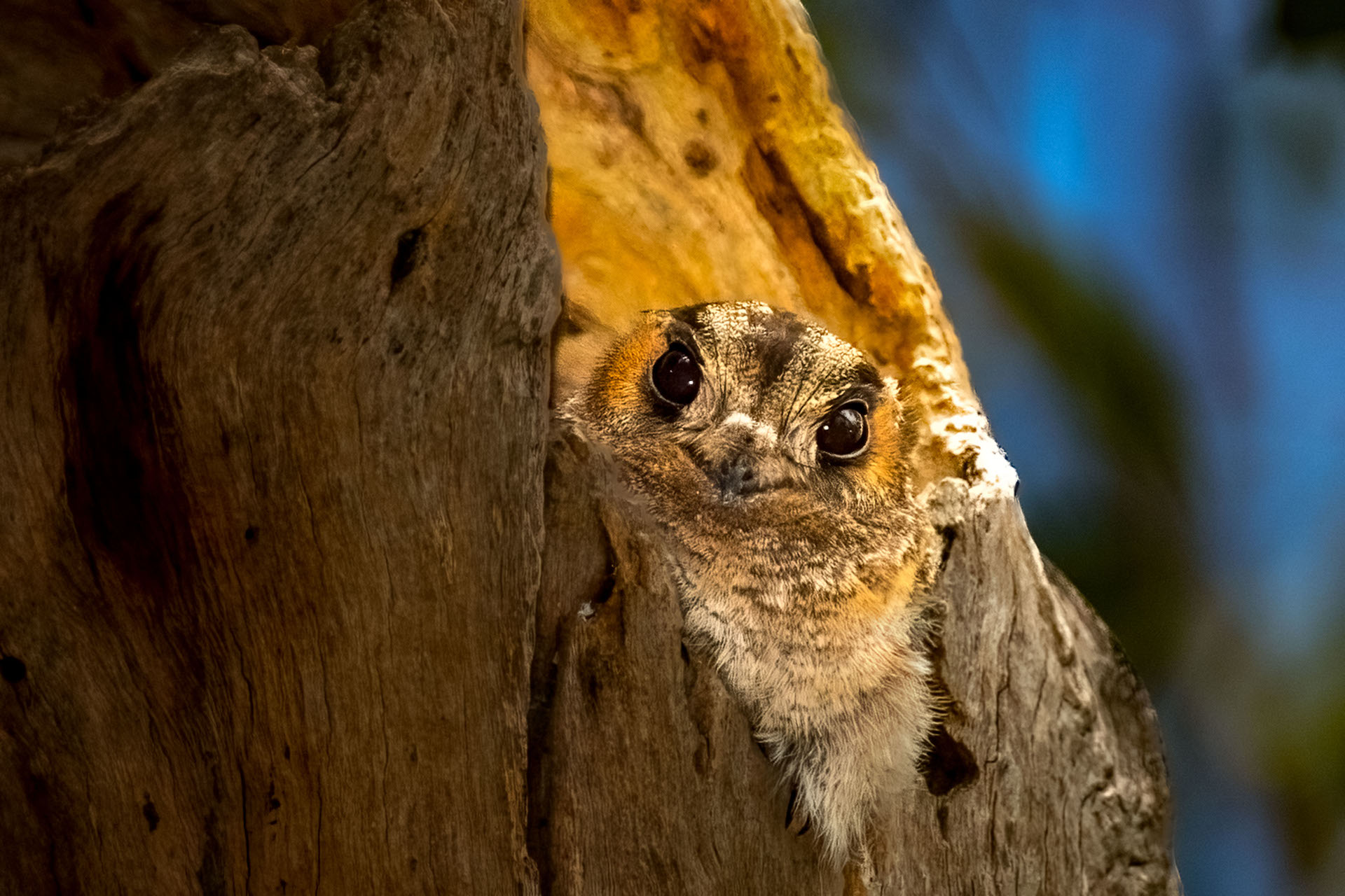
Australian Owlet-nightjar
Aegotheles cristatus
Aegotheles cristatus
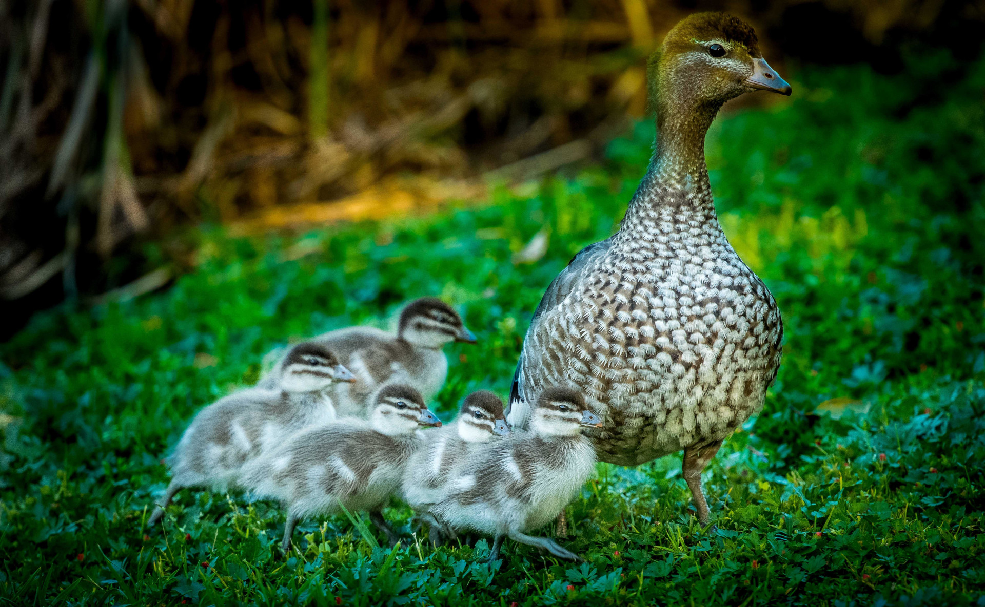
Australian Wood Duck
Chenonetta jubata
Chenonetta jubata
Blackbutt tree
Eucalyptus pilularis
Eucalyptus pilularis
Chestnut Teal
Anas castanea
Anas castanea
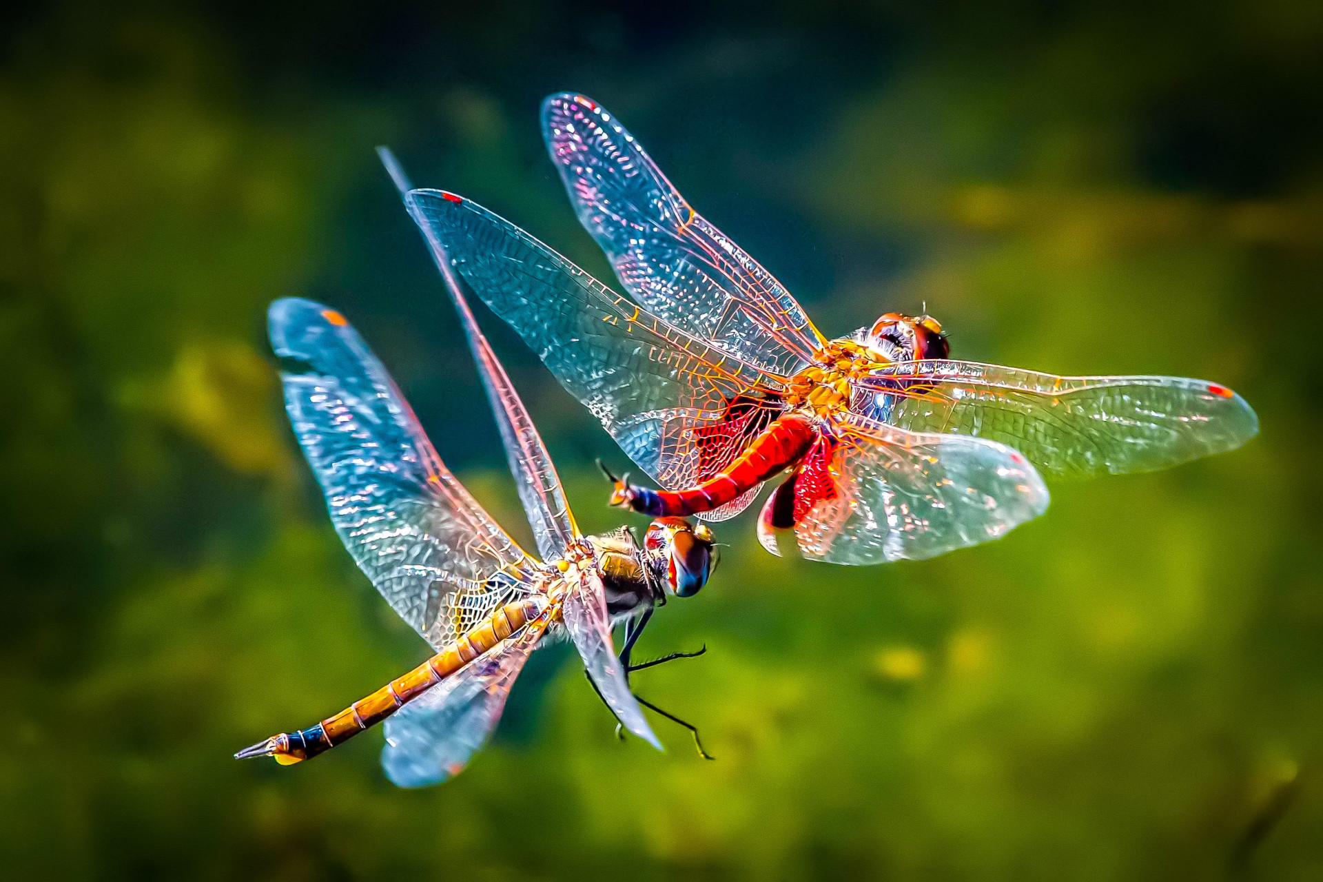
Common Glider Dragonfly
Tramea loewii
Tramea loewii
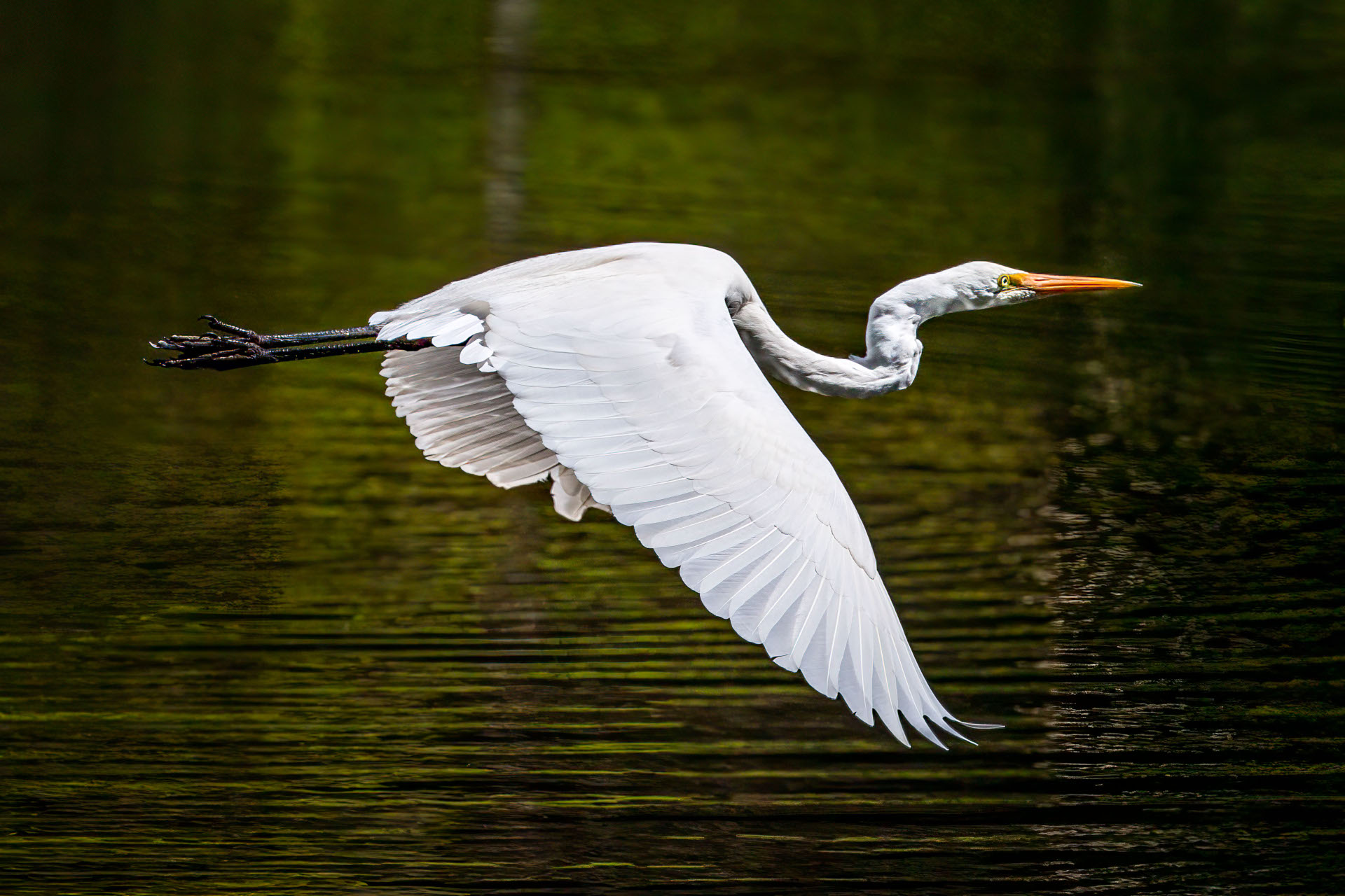
Eastern Great Egret
Ardea alba modesta
Ardea alba modesta
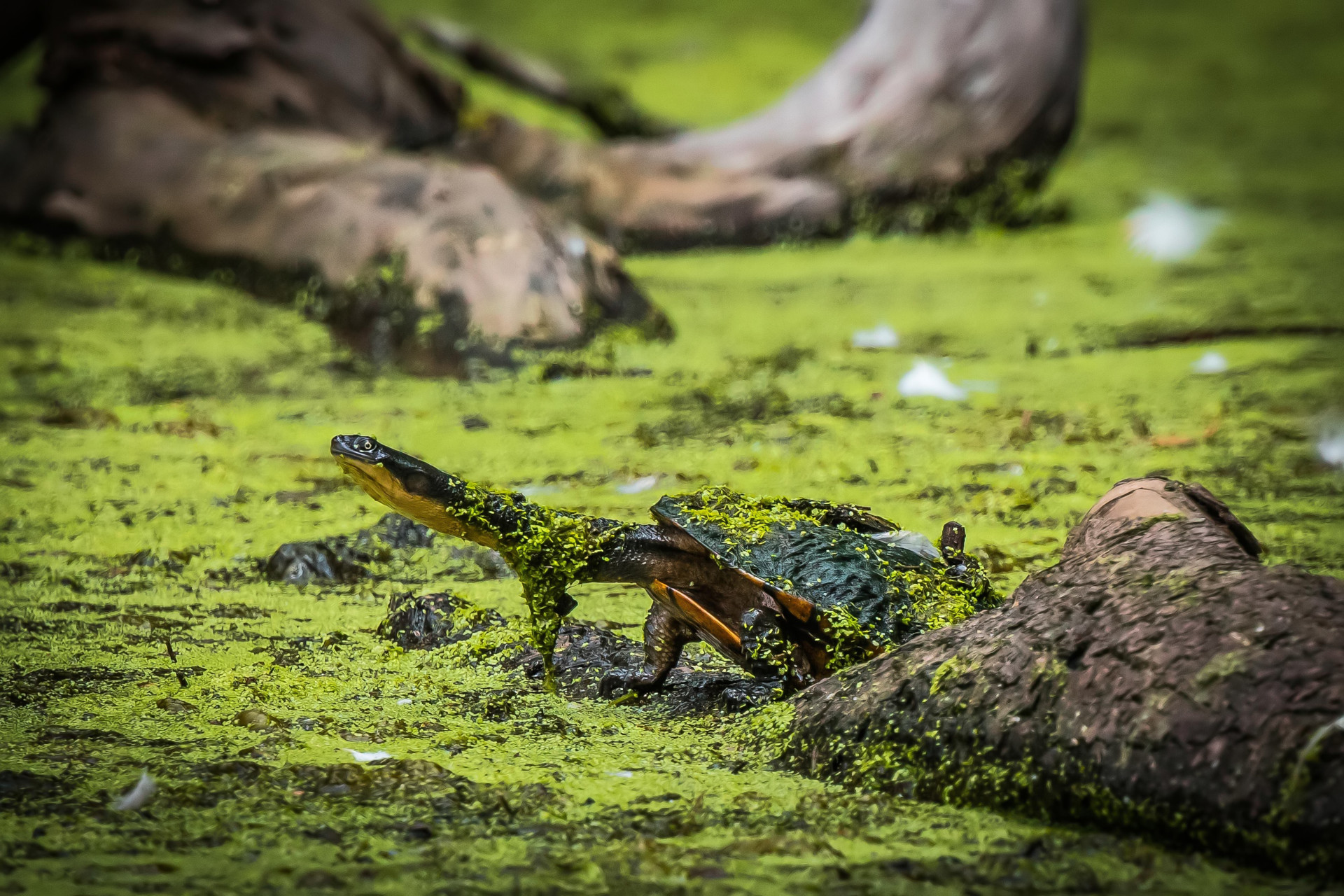
Eastern Long-necked Turtle
Chelodina longicollis
Chelodina longicollis
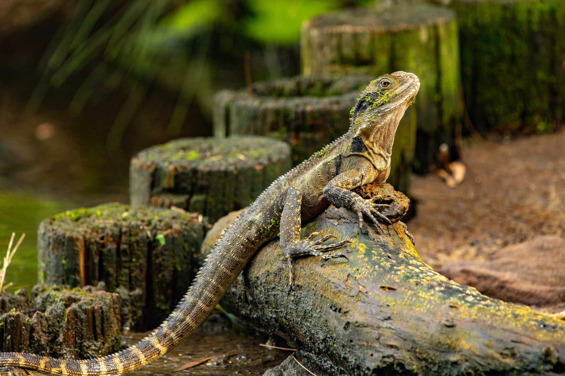
Eastern Water Dragon
Intellagama lesueurii lesueurii
Intellagama lesueurii lesueurii
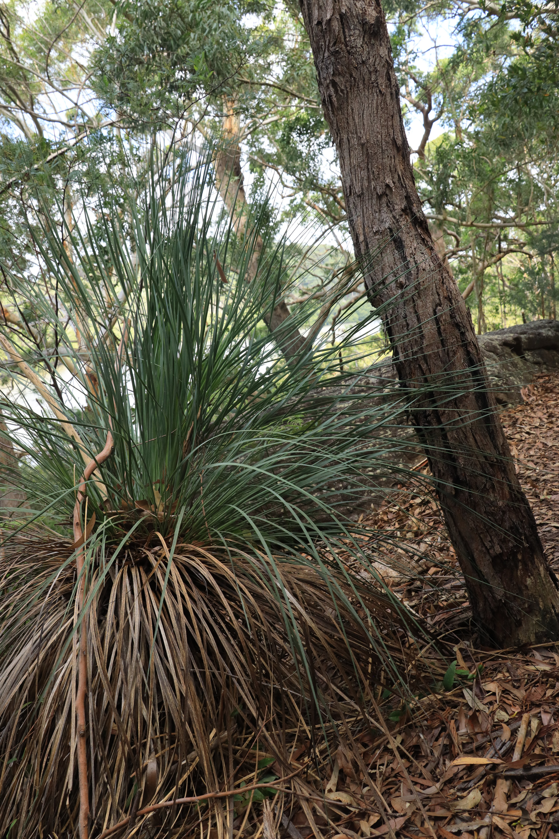
Grass tree
Xanthorrhoea
Xanthorrhoea
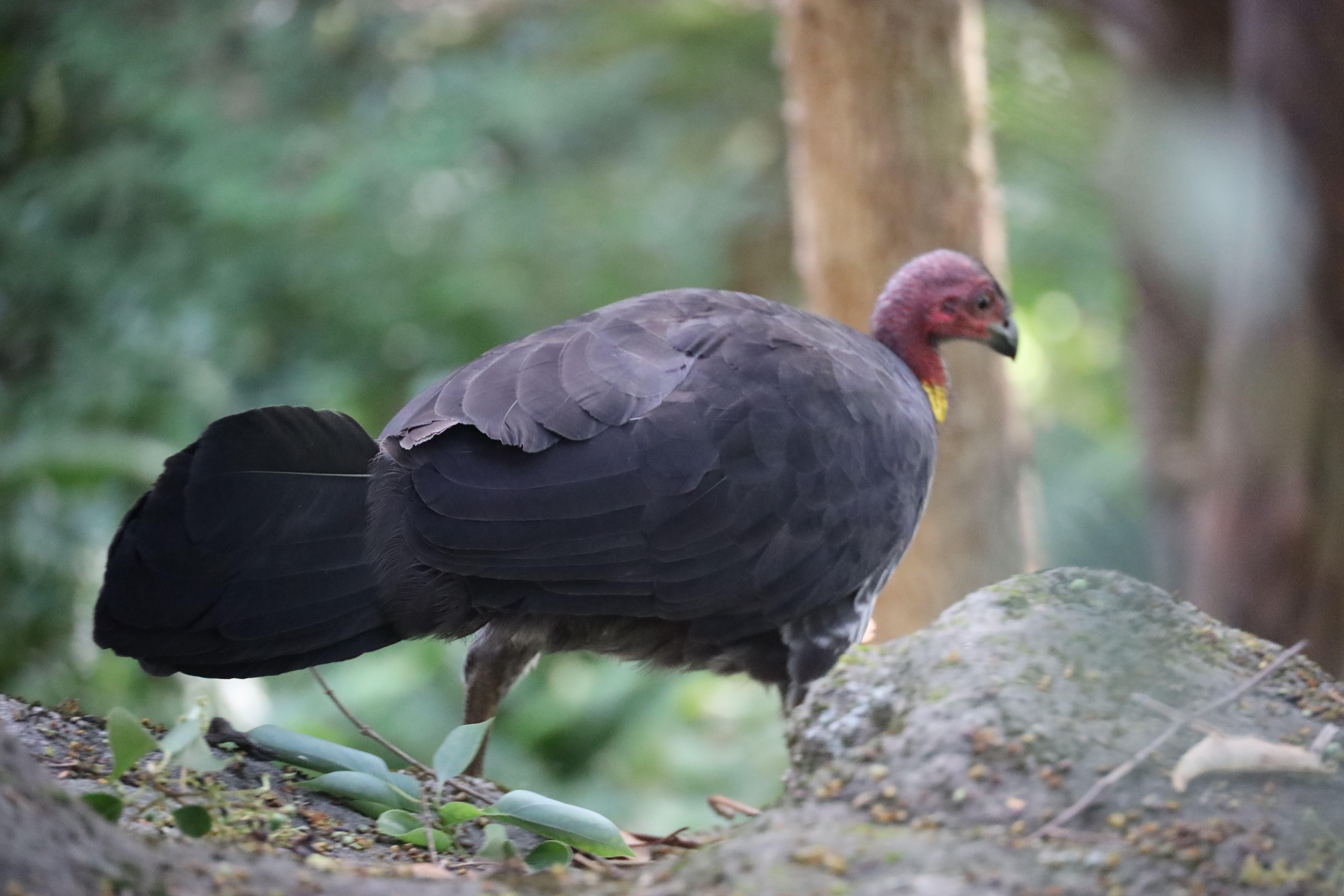
Australian BrushTurkey
Alectura lathami
Alectura lathami
Images
Points of Interest
The LPA advocated to open a school in Lugarno and played a formative role in establishing Lugarno Public School. The LPA wrote a letter to the Minister for Lands on the 12th July, 1927. This letter was passed to the Department of Education, and Mr. Inspector Price was asked to report if steps should be taken to secure a school site in the Lugarno area. In 1928 Inspector Price informed the Chief Inspector that he was too busy to visit Lugarno until early in the new year, and was of the opinion that the matter was not one of urgency. The Headmaster of Peakhurst Public School, Joseph D. Woods, was asked to report to Inspector Price. The Peakhurst Public School was the closest school to Lugarno at this time, and the report lists the names and ages of pupils at Peakhurst who lived at Lugarno, with the distance they travelled, plus the principal's opinion on the appropriateness of a new school in Lugarno. It was decided to provide land for the school, but to defer opening a school. Soon the Progress Association and the local Member of Parliament, Fred Stanley were pressing for a school to be erected on the site provided. The bus to Peakhurst was a major issue. In May 1930 the Lugarno Progress Association wrote to the Minister for Education, pointing out that if the children were dismissed early they must walk along a lonely road, or wait at a lonely corner for the bus to come, which exposed the children to moral and physical danger. At this time most Lugarno residents were not wealthy, and would have been affected by the Great Depression. On the 17th July, 1933, the Member of Parliament Mr. C Monro was informed (after years of advocacy by the LPA and local MP's) that the application for a school at Lugarno had been approved and the official opening took place on the 28th October, 1933. It had a playground of 3 1/2 acres had accommodation for 40 to 50 pupils. Initially Miss Delia King was appointed the first teacher in charge of the school, and was also its only teacher. There were eight girls and nine boys to teach.
There are remains of a quarry on the southern contact of the volcanic intrusion of Evatt Park (where the sandstone had been baked hard). The quarry was established by George Stanley Connor (aka Stan) during the late 1920s for road metal. The stone was sold to the local council and transported by truck to Peakhurst and Stoney Creek Road where it was mostly used as road base. They frequently had to drill, blast and screen the material, and load it onto council trucks.
Another quarry was opened near the river (at the end of what is Allwood Crescent today). Here Llewellyn Jones and Harry Whitwell built a dam, put in a stone crusher and made some barges. The stone was transported down the river by barge, pulled by a boat called the Swift, to Cooks River, where Botany/Bayside Council used it for road base.
In the 1960s there was pressure for the rezoning of market gardens to permit residential development. Fortunately, with great foresight, the County of Cumberland Planning Scheme had reserved the market garden area for recreational purposes in 1951. Despite being aware of the fact, Shirley Constructions bought the site in 1963, hoping the land would be rezoned. The Lugarno Progress Association (LPA), residents, and eventually Hurstville Council agitated for three years until the State Planning Authority resumed the market garden in 1965, and handed it to Hurstville Council who named it H V Evatt Park.
Evatt Park in Lugarno, NSW, was named in December 1965 to honor Herbert Vere (Doc) Evatt (1894–1965), a prominent Australian Labor politician, High Court judge, and diplomat. The park was named following his death, honoring his service as the former Member of Parliament for the local electorate of Barton.
Doc Evatt was a significant historical figure who served as Attorney-General, Minister for External Affairs, and was a key figure in the founding of the United Nations.
Ernie Webb was a market gardener in Menai. In 1927 (the same year that electricity reached Lugarno), he leased the orchard from Ella Connor & George Stanley Connor ("Stan"). By the 1930's the arrival of the fruit fly had caused havoc in local orchards, so Ernie began the back-breaking job of removing the fruit trees. Vegetables rather than fruit were the main income earner. The local volcanic soil produced high quality vegetables. At its peak, the gardens had a turnover of 15 thousand pounds per year.
It was one of the few market gardens in Sydney supplying early season vegetables to Sydney markets within a day of picking. During WW2 the gardens provided vegetables for the defence forces. At one stage the army took over the house, Valencia, and a small part of the grounds for repairing troop carriers.
In 1948, Ella Connor sold 20 acres of “Valencia”, the orchard part, to Ernie Webb who
continued to run the market garden, but moved out of the old homestead.
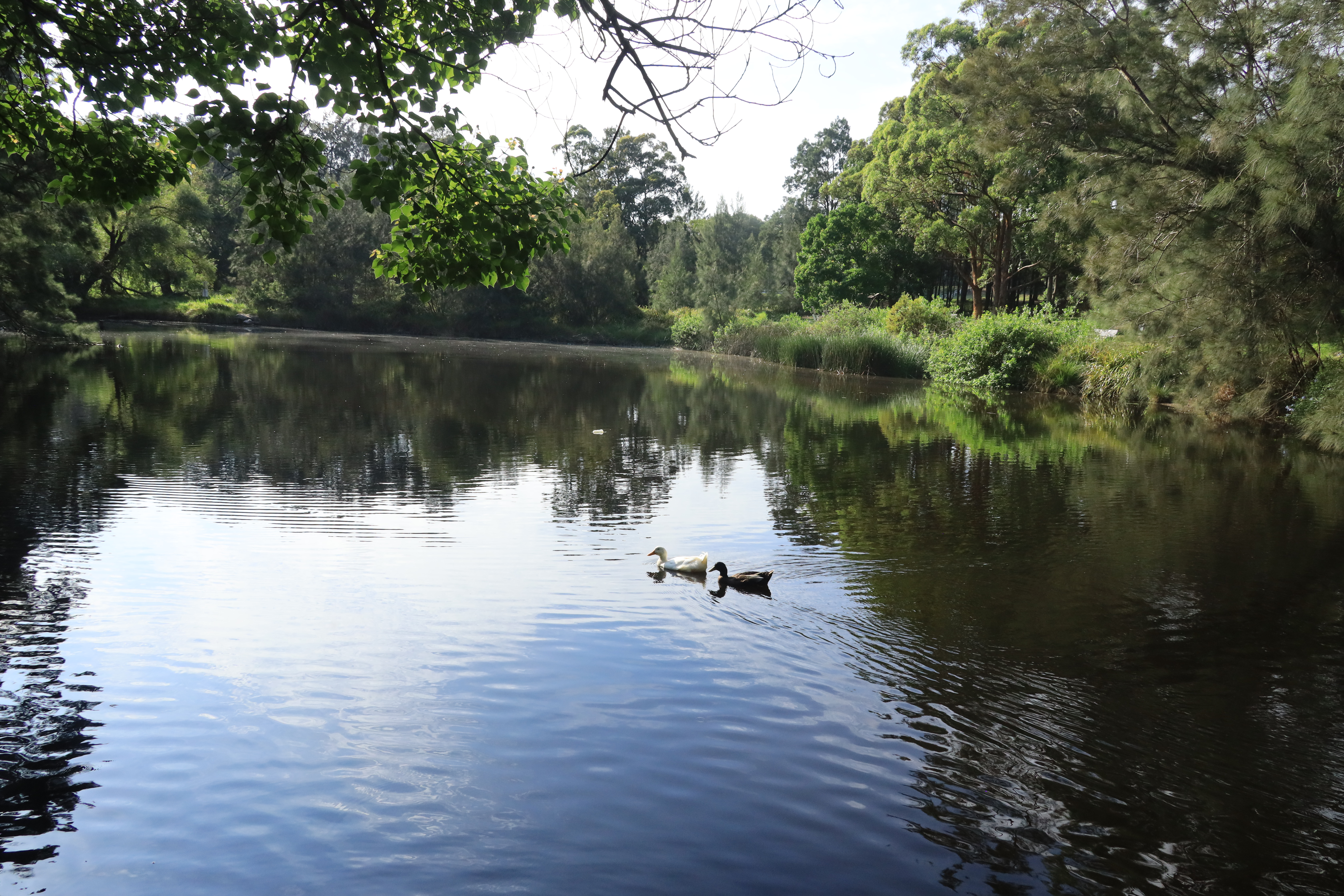
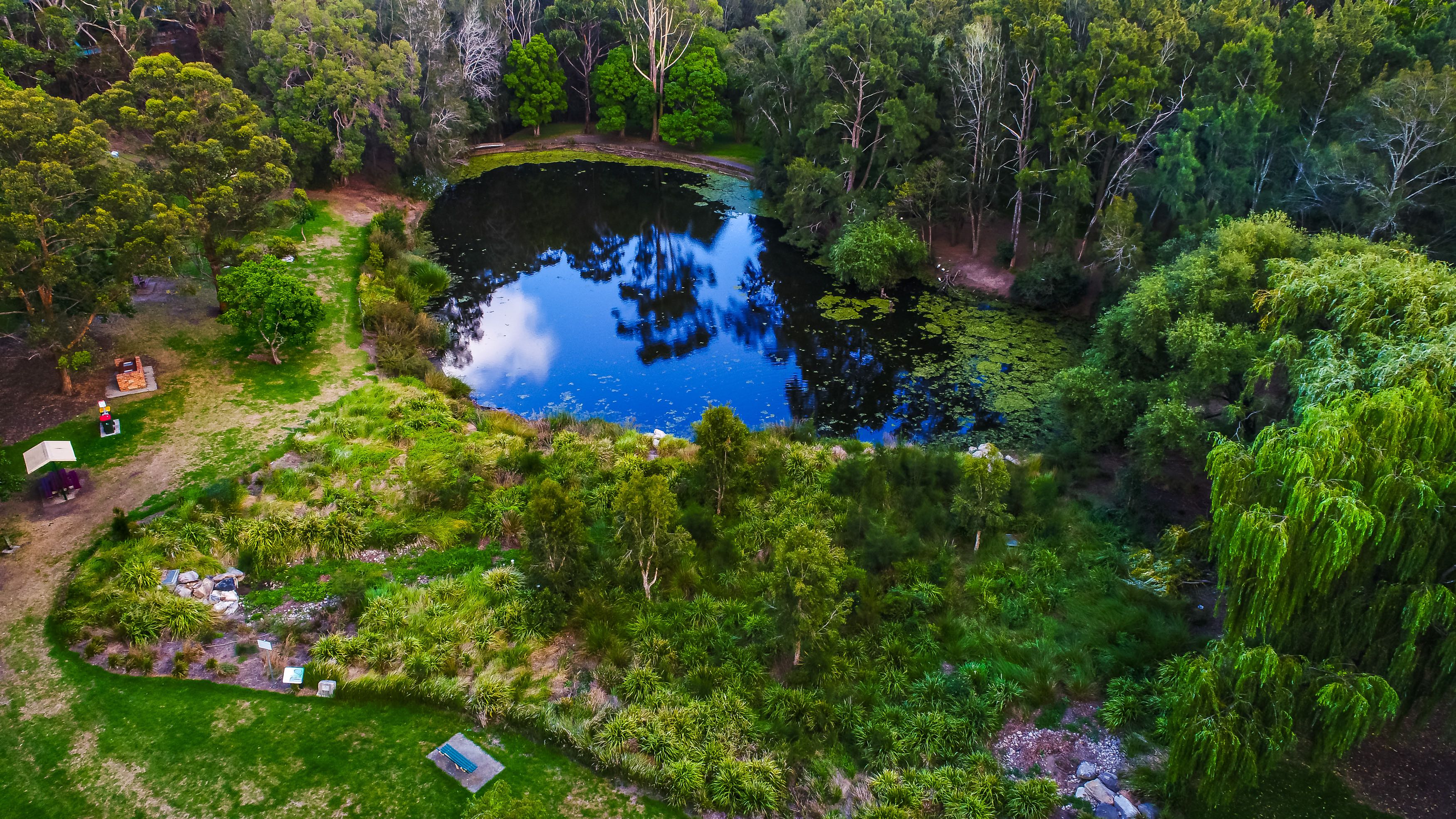
A small dam on the site was enlarged a number of times in order to provide the large quantity of water required for the gardens. By 1957 it contained one million gallons of water and today it is the centrepiece of Evatt Park. Some of the original willow trees, planted by Ernie, at the water’s edge, provide shelter for the myriad of water birds that call the area home.
The orchard was located in a natural bowl between surrounding sandstone ridges, caused by an intrusion of basic volcanic breccia. The soil on top of the volcanic intrusion was more fertile than the surrounding ridges.
The land in this area changed hands multiple times. Some of the very old fruit trees had been replaced during the period 1900-1905 and some newer varieties planted. The property was not irrigated and had to rely solely upon rainfall for growth.
Ella Boyd, inherited the well-established 20-acre orchard in trust on 2 April 1913. At that time it supported a spreading orchard and extensive vegetable garden. Her husband George Stanley ("Stan") Connor worked on the farm which grew to have 40 chickens, 5 horses, 4 bee hives, cows and numerous dogs (to keep pilferers at bay). Plus the waterfront foreshore provided the family with access to oysters and fish.
The orchard had Granny Smith and Jonathan apples; Moore Park apricots; St. Michael, White Siletta, Joppa, Valencia and Washington Navel oranges; China pears (for cooking) and Williams pears (for eating); peaches and nectarines; Lisbon lemons; Wickson plums; and mandarins. The Connor family tried growing grapes also but the crops did not survive the hot summers and, eventually, the vines were ripped out.
Vegetables were also harvested - cucumbers, rockmelons, tomatoes, beetroot, watermelons, peas, beans, cabbages, and potatoes. Over time, vegetables became the main source of year-round income; the fruit provided seasonal income.
The orchard and vegetable garden required constant attention and horsedrawn ploughing. The produce was taken at night along Forest Road to the Haymarket in Sydney. Stan had a cartage arrangement with neighbour Mr. Ernie Webb and some of his market gardener friends on the other side of the George’s River. In the beginning, the produce was carted by horse and dray, but eventually trucks took over.
These few plum trees in Evatt Park are a remnant of that orchard, a fragment of history clinging to the past while enlightening the present moment.
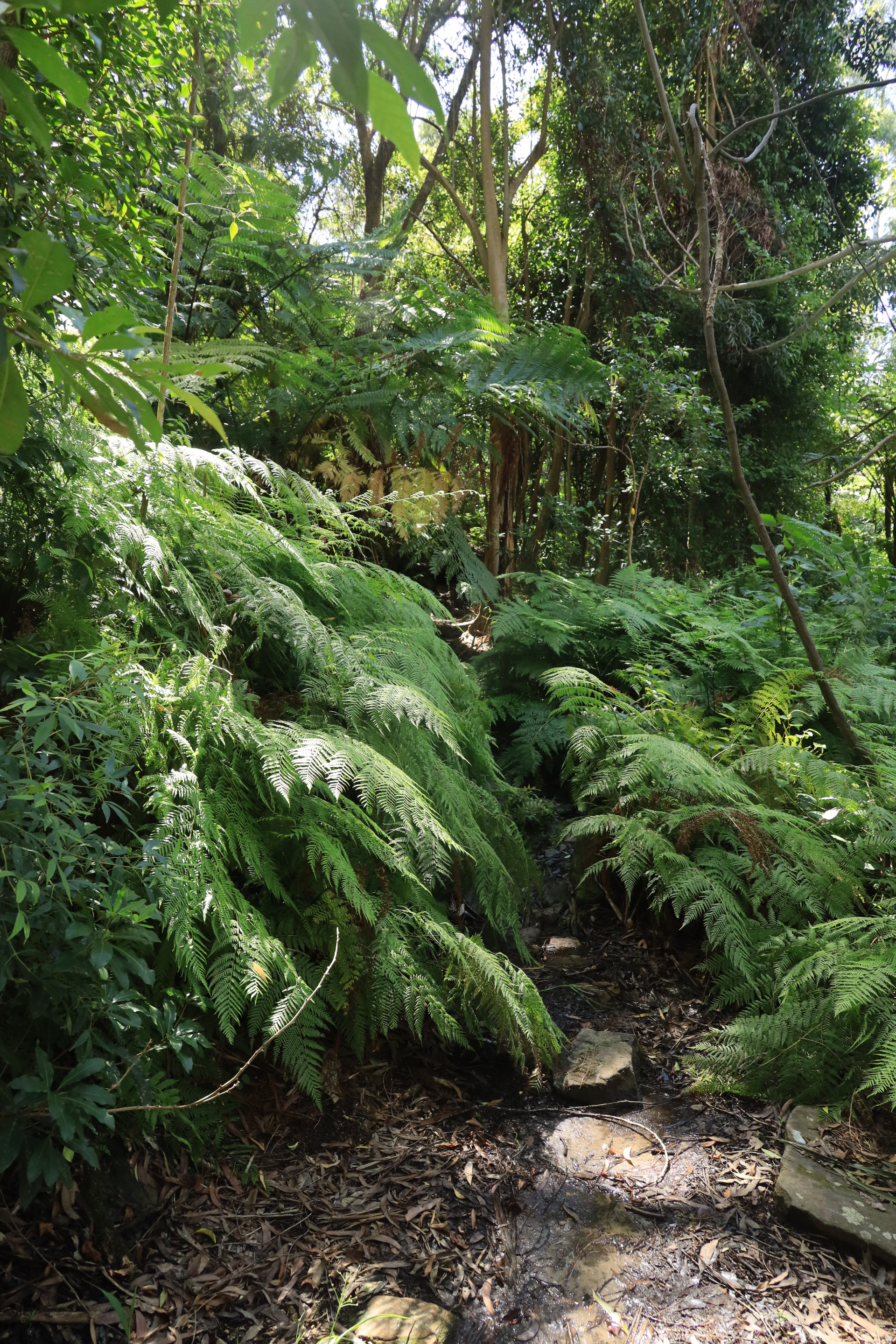
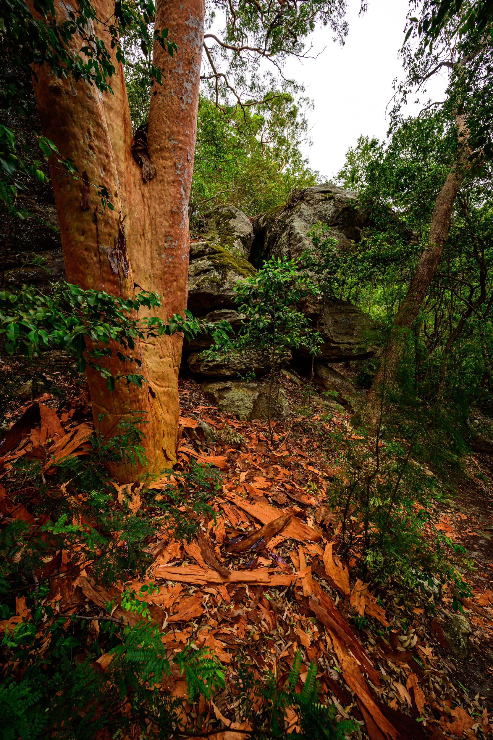
The first part of the track is the rainforest section, which you will see from the ferns, vines, figs and water. This is a narrow path with boardwalk and stepping stones. The creek has warm temperate rainforest with Coachwood trees and Lilly Pillys. There is a broken dam over the man-made creek along here. The fresh water stream still runs beneath the vine covered trees and a carpet of ferns flourish amongst the mossy rocks. In autumn, the decomposing tree trunks are littered with a range of coloured fungi. On the higher, more exposed parts of the track a scattering of flannel flowers, native fuchsia and ground orchids can be found.
As you walk along the rainforest track, look up for the birds including sea eagles, the powerful owl camouflaged in the trees, and many types of parrots. The bush is a haven for reptiles and occasional echidnas and other wildlife. Native bushflowers are magnificent at many times of the year but spring can be particularly colourful.
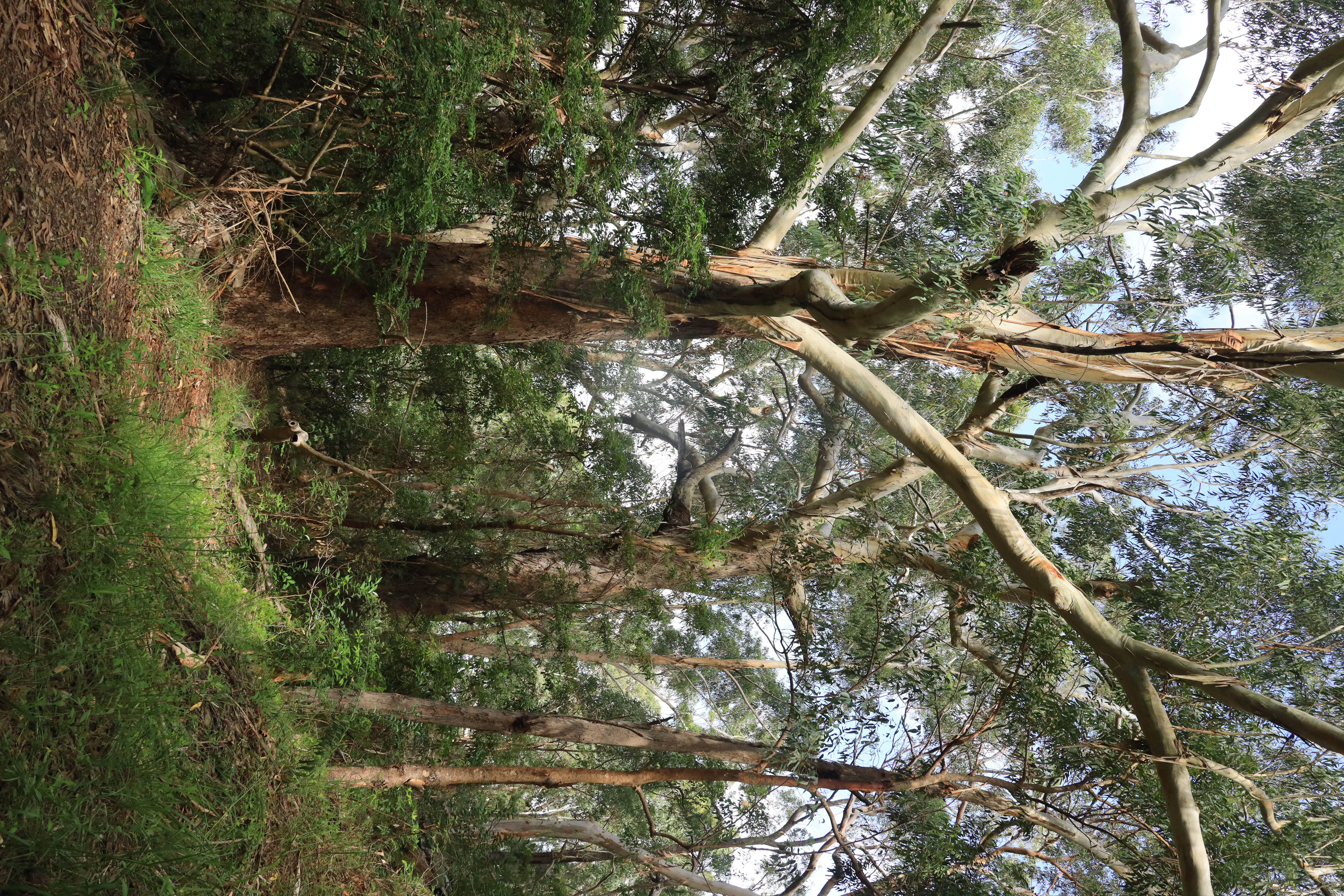
The Lugarno peninsula has Hawkesbury Sandstone vegetation of Sydney Red Gums, Grey Gums, Sydney Peppermint and Blackbutts. Along the foreshore, the landscape conservation area is dominated by Grey Mangrove with some smaller River Mangrove and Swamp Oak.
There are middens on the lower track nearer the river. You will see the branch off to the lower track as you walk. Oysters were a staple in the diet of the Bidjigal people and found in abundance on the rocks and mangrove roots in the Georges River. But with the arrival of Europeans to the area, there was excessive harvesting for food, and to use middens for mortar, so the oyster supply soon became depleted. It was then the oyster farming industry was born. In fact, the Georges River became one of the first areas for successful commercial oyster cultivation. John Geddes began farming oysters in Lugarno in 1886. His oyster leases were taken over by the Matthei family who began farming oysters on slabs of sandstone formed in parallel rows as far out as the low-tide mark. Later they used trays constructed of wire mesh mounted on wooden frames and coated in tar. It took two to three years for a crop to mature.
Adolph Peters had a lease in Edith Bay, there were leases in the Moons and those owned by the Bowmaker family. Georges River oysters were renowned for their size and flavour and in the 1940s and 50s had a reputation as the finest in the world. Poachers were a constant problem and farmers who had worked all day, had to stake out at night to catch the thieves. In the 1980s Georges River produced most of the oysters sold in NSW, but in 1994 there was a major outbreak of QX virus and oyster leases were removed from Georges River.
There are caves on the lower part of the walk, which were used by the traditional owners of the lands here, the Bidjigal people of the Eora nation. Their land includes Salt Pan Creek and the Georges River. They are part of the Dharug language group. They used the river as a travel route, food source and meeting place, with seasonal fishing and shellfish gathering. The river was also used by early European settlers for timber getting, fishing and oyster leases. Remnant jetties can be found down near the waterline, and many were used by timber getters. There are middens on the lower track nearer the river.
You will see the Cave if you branch off to the lower southern track as you walk around the peninsula.
Prior to the 1800s, Lugarno was heavily timbered with Blackbutt, Ironbark, Turpentine and other giant eucalypts, often towering to over one hundred feet. These trees were a valuable asset to the growing colony. Turpentine was much sort after for Sydney wharves, being almost imperishable in water. Timber-getters opened up the area in the 1800s, seeking to make their fortune. They were said to be colourful, rowdy men, who camped in the bush and lived on a diet of salt beef and damper. Timber was taken to Sydney by bullock dray and used for building construction, coach building, wheelmaking, boat building, the construction of wagons and carts, and firewood which at that time was selling for six shillings a load.
The men working in saw pits had the hardest job. The man on top having to lift the saw after each descending stroke, while the man below caught the down draught of sawdust in his face. Early maps of Lugarno show wood carter’s tracks where the timber was carried from Crown land that has now become Lugarno Parade, Elm, Oak and Cedar streets, to the Government Road. Timber was also removed along the river.
From 1927, John Edmund Boatwright started selling 9 ‘weekender’ lots at the end of Blackbutt Avenue, overlooking the Pleasure Grounds. He built a set of steps to the Henley Pleasure Grounds where there were boats for hire and great fishing. These lots are now 56-72 Blackbutt Avenue.
Blackbutt Avenue is named for the Blackbutt (Eucalyptus pilularis) trees, a prominent native species in the Lugarno area where they are part of the local ecosystem. These tall, fast-growing hardwoods are recognized by their rough, charred-looking bark at the base and are a significant part of the area's natural landscape.
Murdock Crescent is a natural reserve on the site of the historic Henley Pleasure Grounds. Henley Pleasure Grounds was developed by John Edward Boatwright from 1926. The land ran from Forest Road to the river and established a picnic area (complete with a stone boatshed), wharf, pontoon, boat hire and flying fox.
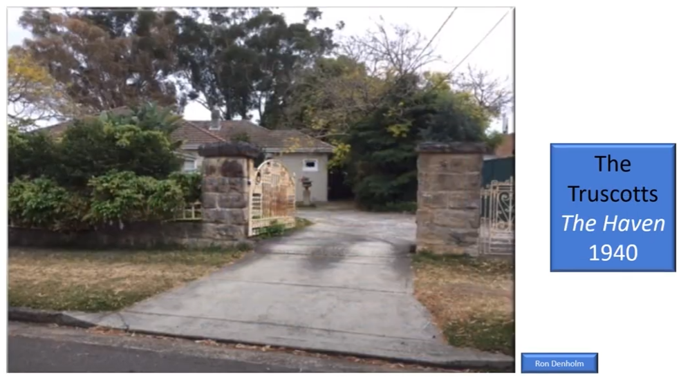
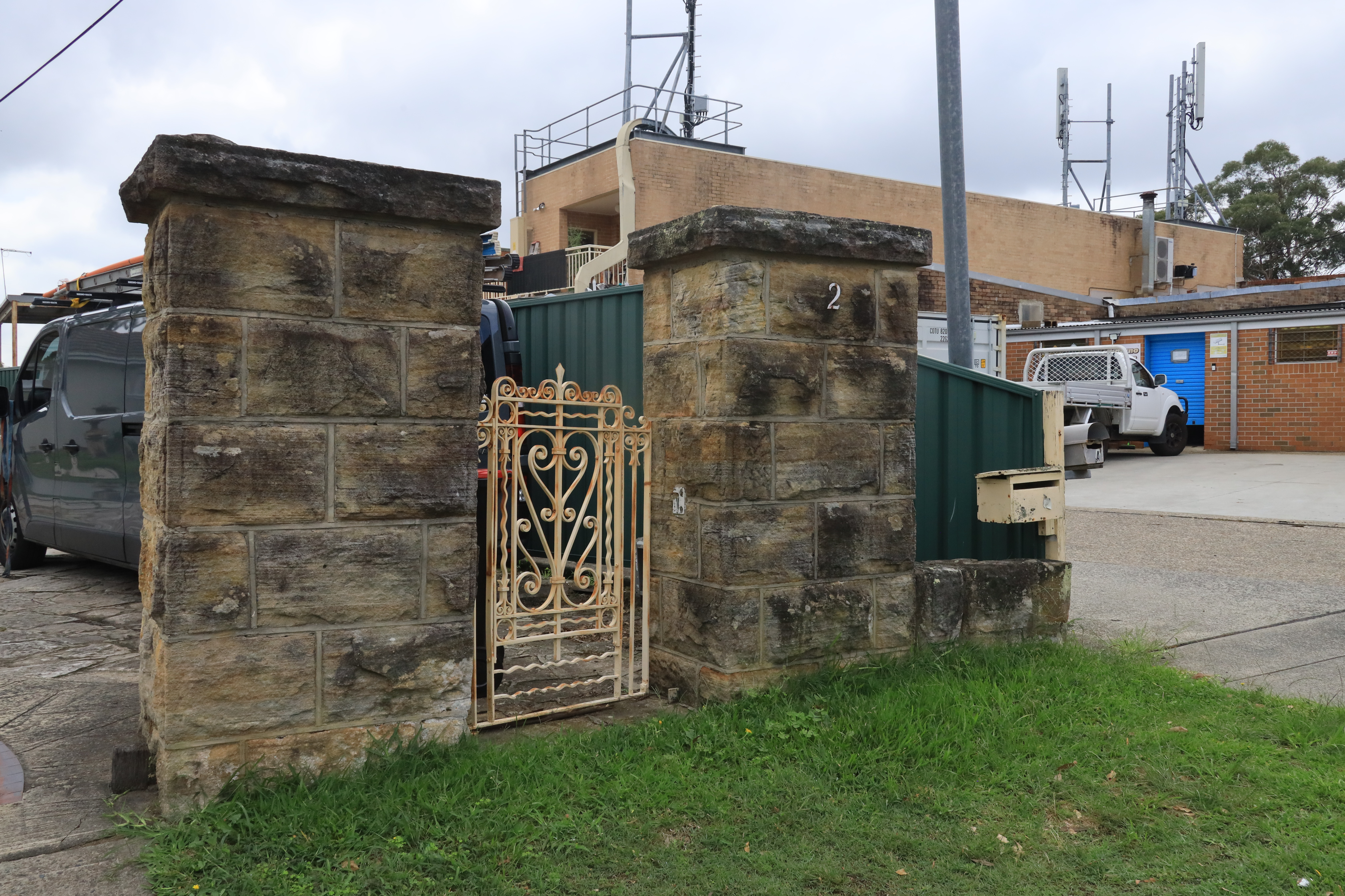
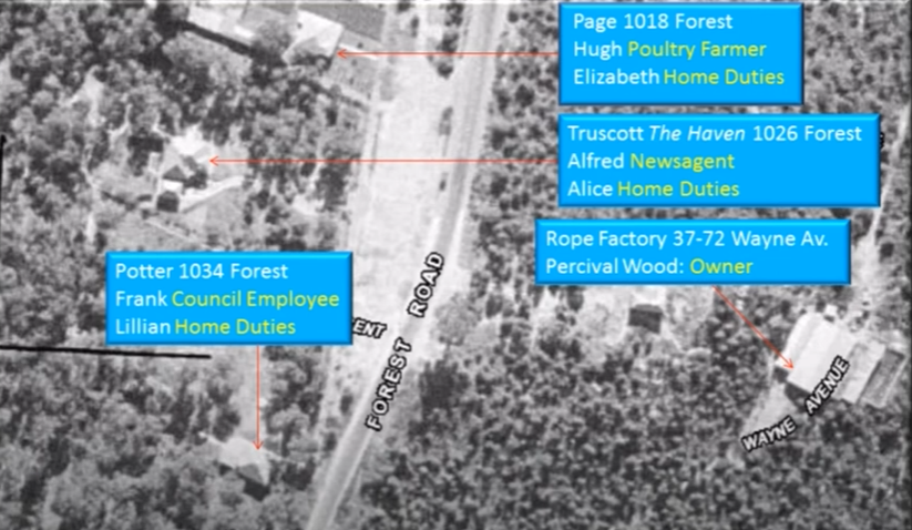
In 1940 blacksmith, then newsagent Alfred Truscott, built ‘The Haven’ at 1024 Forest Road. It is a 900 pound brick home. He created the beautiful entrance gate on which you can see Salt Pan Creek motif and four fish.
Lugarno shopping strip was once the property of Alice and Alfred Truscott. A stone fence ran the width of their block, set back from Forest Road. Alfred paid 500 pounds for the seven acres running from Forest Road to the river. Sadly, just seven years after Alfred built his dream home, he died, and Alice and her daughter Kath, were left alone. Kath married Ken Jaegar who had a newspaper circulation. Each morning he would deliver papers through Lugarno, Peakhurst, across to Menai and as far as the Woronora River. In the afternoons he operated a small newspaper stand outside Truscott’s fence. He sold evening newspapers, sweets and drinks, by lamp light.
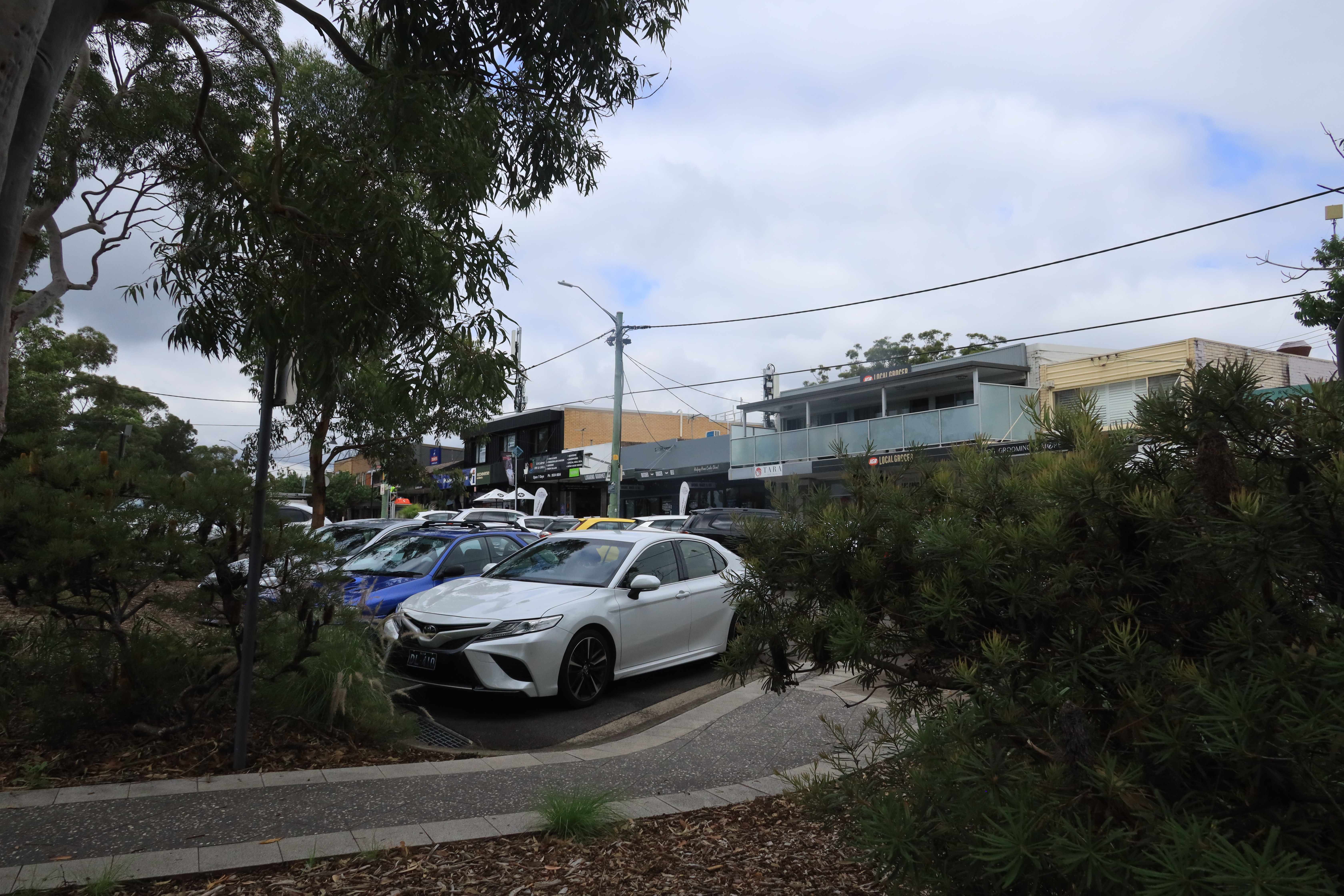
In 1956 Laurie Thompson took over the stand and 12 months later bought land from Alice and built a news agency where it stands today. In the late 1950s, Alice subdivided the rest of the property and the shop lots along Forest Road were sold for two thousand pounds each. A remnant of Truscott’s stone fence still runs along the side of the house in Grandview Crescent.
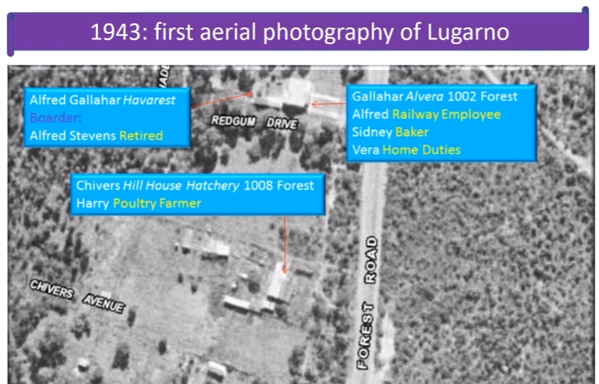
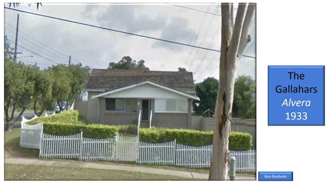
Baker, Sydney Herbert Gallahar and wife Susannah Elizabeth, built ‘Alvera’ at 1002 Forest Road. They kept cows on the property.
Bushwalking tracks are natural environments with inherent risks, including rapid weather shifts, changing terrain, and limited mobile coverage.
Information provided by Lugarno Progress Association is a guide only.
Walkers are responsible for assessing their own fitness, ensuring proper equipment, and checking live local alerts (such as the Hazards Near Me app) before setting out.
Always let someone know of your planned route.
Lugarno Progress Association accepts no liability for any loss, injury, or damage incurred by relying on this information.